The change in leaf area across the globe (1982 – 2015)
A new study reveals that increases in leaf abundance are causing boreal areas to warm and arid regions to cool.
Read MoreMaps depicting environmental degradation across planet.
A new study reveals that increases in leaf abundance are causing boreal areas to warm and arid regions to cool.
Read MoreReddit user: galileo23
Read More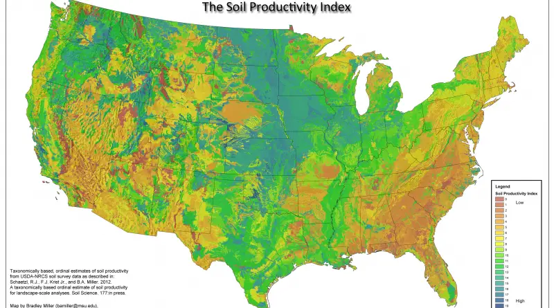
Syria’s electricity infrastructure has been destroyed by six years of war. Images from NASA show precisely how the lights have gone out during the course of the war, leaving people to survive with little to no power.
Read More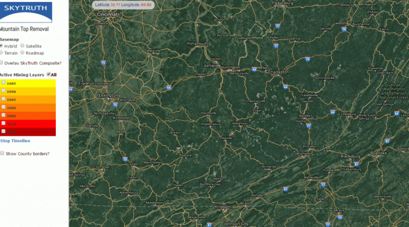
Source: skytruthmtr.appspot.com
Read MoreCartogram showing the participating countries in the final of Eurovision Song Contest 2017 resized according to the total number of
Read MoreReddit: sendherhome22
Read More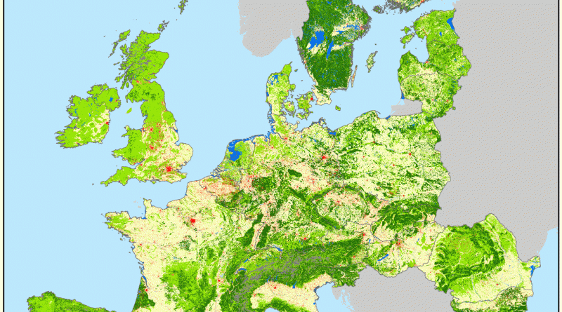
EU27CH – gross land changes processed by HILDA model (v2.0). Source: wur.nl
Read MoreReddit user: sangeetpaul
Read More