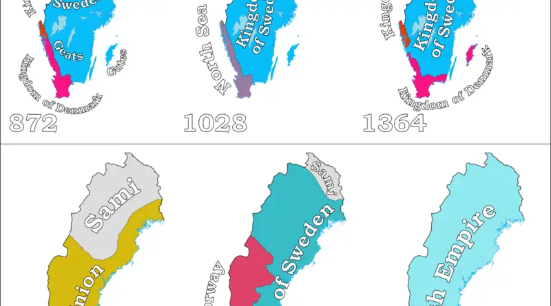
Historical Maps

Historical maps showing territorial changes of countries and historical events of the past.
Historical Maps

European exploration of North America Mapped

During the Age of Exploration in the late 15th to 18th centuries, European powers embarked on expeditions to North America, driven by a quest for new trade routes, wealth, and strategic advantages. Christopher Columbus’s 1492 voyage under the Spanish flag marked the beginning of European interaction with the continent. Subsequent explorers, including those from England and France, ventured into North America, leading to territorial claims and cultural exchanges with indigenous populations. The exploration had far-reaching consequences, influencing the course of colonization, trade, and cultural dynamics on the continent.

Read More
Historical Maps

Medieval universities in Europe

Medieval universities in Europe were key institutions of higher learning that emerged during the Middle Ages, roughly spanning from the 5th to the 15th century. These institutions laid the foundation for modern education systems and played a crucial role in shaping various fields of study, religious thought, and societal structures.

Read More
Historical Maps

Abolition of Slavery by Country

The abolition of slavery happened at different times in different nations. It often occurred consecutively over one stage–for instance, as the abolition of the trade of enslaved people in a specific country and then as the abolition of slavery throughout empires. Each step was usually the result of a separate law or action.

Read More