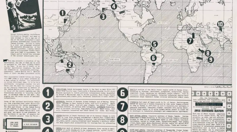
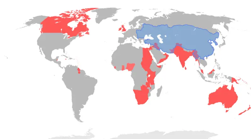
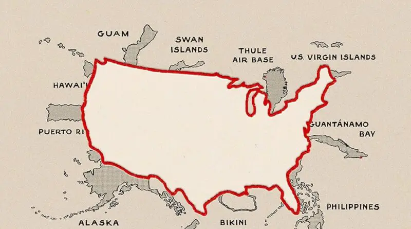
Skip to content
Vivid Maps Logo

Vivid Maps

Maps that explain the World


  • Atlases
  • Map Posters
  • Scratch Maps
  • Globes

Historical Maps

Historical maps showing territorial changes of countries and historical events of the past.
Settelments in the United States
Historical Maps 

The first non-native country to make a settlement in each of the U.S.

February 5, 2018 Alex 2 Comments United States

  Countries who founded first non-native settlement France: North Dakota, South Dakota, Minnesota, Wisconsin, Iowa, Illinois, Indiana, Michigan, Missouri, Maine, Vermont,

Read more
World War 2 Deaths
Historical Maps 

The number of deaths in World War 2

January 18, 2018February 27, 2021 Alex 0 Comments Europe, Maps of world

World war II was the deadliest military conflict in history in Absolute terms of total casualties. Over 60 million people

Read more
countries invaded by the Netherlands
Historical Maps 

All countries “invaded” by the Netherlands

January 17, 2018 Alex 1 Comment Netherlands

Reddit user: carolusmegamagnus

Read more
Historical Maps Wars 

The number of death in WW1

January 17, 2018July 17, 2020 Alex 3 Comments Europe, Maps of world, WW1

The entire amount of military and nonmilitary casualties in WWI were about forty million: calculations vary from 16 to 20 million deaths

Read more
Slavery in Americas
Historical Maps 

Slavery in the Americas

January 15, 2018October 16, 2020 Alex 0 Comments Americas

The first Africans brought to the Americas went in small amounts, mainly via Spain and Portugal. The expansion of Brazilian

Read more
Historical Maps 

Stalin’s secret war plans

January 13, 2018 Alex 0 Comments USSR

Map published in the American newspaper Saturday Evening Post on September 20, 1952. The map illustrates an article by General

Read more
Cities Historical Maps 

20 largest U.S. cities, 1790

December 19, 2017December 27, 2017 Alex 0 Comments United States

ProjectFailure 20 Largest U.S. Cities in 1790 1. New York, NY: 33,131 2. Philadelphia, PA: 28,522 3. Boston, MA: 18,320

Read more
Historical Maps 

The Changing Shoreline of New York City

December 16, 2017February 4, 2020 Alex 0 Comments New York

The Changing Shoreline of NYC studies key points along New York City’s shoreline with a particular focus on Manhattan’s waterfront

Read more
Historical Maps 

New France (1750)

December 6, 2017December 27, 2017 Alex 0 Comments Canada, North America, United States

Wikipedia New France was the area colonized by France in North America during a period beginning with the exploration of

Read more
Historical Maps 

United States of America before Louisiana purchase

December 5, 2017December 27, 2017 Alex 0 Comments United States

deviantart.net The purchase of Louisiana (1803) almost doubled the original area of the U.S. Related posts: – Growth of United States

Read more
Page 5 of 53« First«...34567...102030...»Last »

Advertisement

Find Us On Facebook

Vivid Maps

Trending now

  • Sea leverl rise
    Climate Change, News, Oceans
  • Mapping
  • Largest Ancestry in the United States
    Ethnic maps
  • Animated maps, Demography, News, Vivid maps
  • Great Lakes
    Lakes

Advertisement


Push pin maps · Globe drinks cabinets · Board games · Monopoly · Map-based strategy board games

Vivid Maps Tools

– Find cities with a similar climate
– Find cities with a similar climate (2050)
– How hot cities could be in 2050
– The U.S. Population Lines
– Convert Latitude/Longitude

– About

Copyright © 2021 Vivid Maps. All rights reserved.