Historical Maps
Historical maps showing territorial changes of countries and historical events of the past.
The Fascinating Maps of Modern Greek History
Discover the captivating cartographic representations that illustrate the dynamic history of modern Greece, from its path to independence to its shifting borders over the centuries.
Read MoreThe Survey of London
The Survey of London provides essential reading for anyone wishing to find out about the capital’s built environment. It is
Read More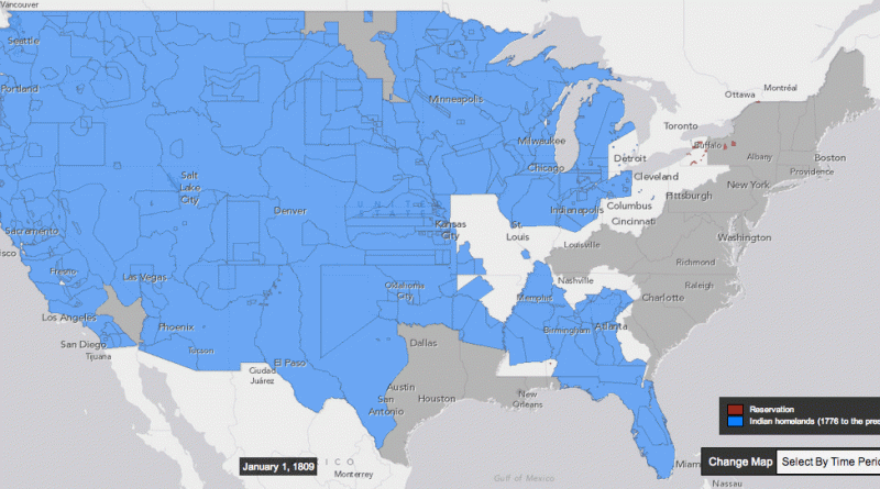
How the United States took more than 1.5 billion acres from native Americans
Between 1776 and 1887, the US seized over 1.5 billion acres from America’s indigenous people by treaty and executive order.
Read More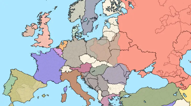
European borders in 1937 over current ones
Related post: – European borders in 1914 over current ones
Read More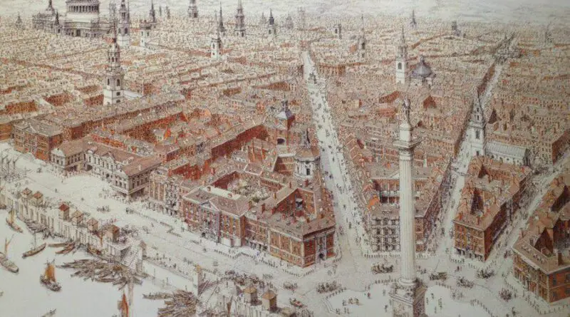
The Great Fire of London (1666)
In the annals of London’s history, few events loom larger than the Great Fire of 1666. This devastating blaze swept through the heart of the city, leaving a trail of destruction in its wake. Yet, from the ashes rose a reimagined metropolis, one that would go on to become a global center of commerce, culture, and innovation.
Read More16th century ethnicity map of Ireland
Via irishorigenes.com
Read More