Greece on the Map: A Century of Territorial Expansion (1832–1947)
From the mountains of Epirus to the islands of the Aegean, modern Greece didn’t begin with its current borders. Its
Read MoreHistorical maps showing territorial changes of countries and historical events of the past.

From the mountains of Epirus to the islands of the Aegean, modern Greece didn’t begin with its current borders. Its
Read More
China, with its rich and intricate history, boasts a lineage of emperors who shaped the country’s destiny for millennia. The imperial reign spanned over various dynasties, each contributing distinctively to Chinese culture, governance, and heritage.
Read More
Time is a fundamental aspect of human existence, and the standardization of time zones has played a crucial role in modern society. In the United States, the evolution of standard time zone boundaries has been a fascinating journey, shaped by historical events, technological advancements, and legislative decisions.
Read More
Similar to the ancient city of Rome, the United States didn’t emerge overnight. It took a staggering 172 years for all 50 states to be woven into the fabric of the Union. This Wednesday marks the 60th anniversary of Hawaii’s statehood, making it the final puzzle piece added to the U.S. mosaic on August 21, 1959.
Read More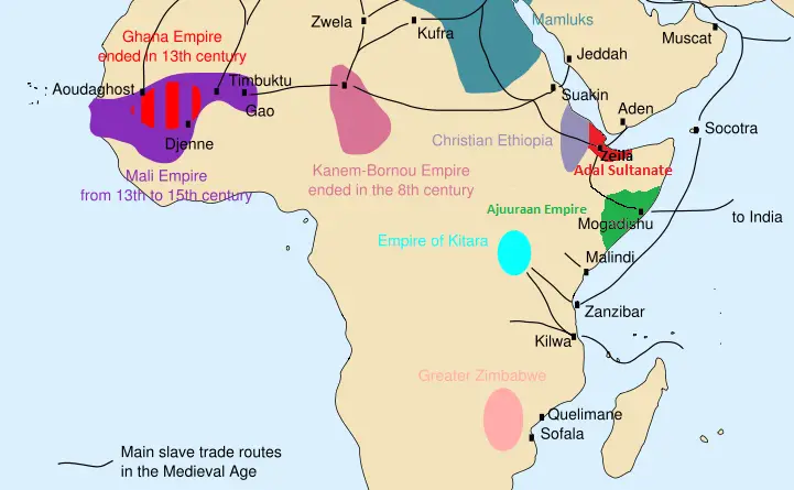
The Arab slave trade lasted for over 1,000 years, affecting millions across Africa, the Middle East, and Asia. Discover its history, routes, and impact, as well as why it remains a lesser-known chapter in world history.
Read More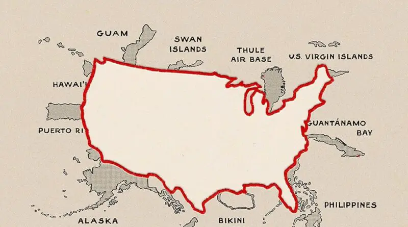
Mapping the Greater United States takes you on a journey beyond the familiar 50 states. With insights from Daniel Immerwahr’s How to Hide an Empire, this post reveals the fascinating history and current status of U.S. territories and former territories that gained independence. Read on for a deeper look into how these regions continue to influence the nation.
Read More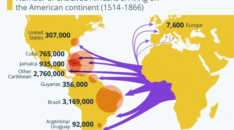
For over 400 years, the transatlantic slave trade shaped the world, uprooting millions from Africa and forcing them into brutal labor in the Americas. This post explores the scale, horrors, and lasting impact of this dark chapter in human history.
Read More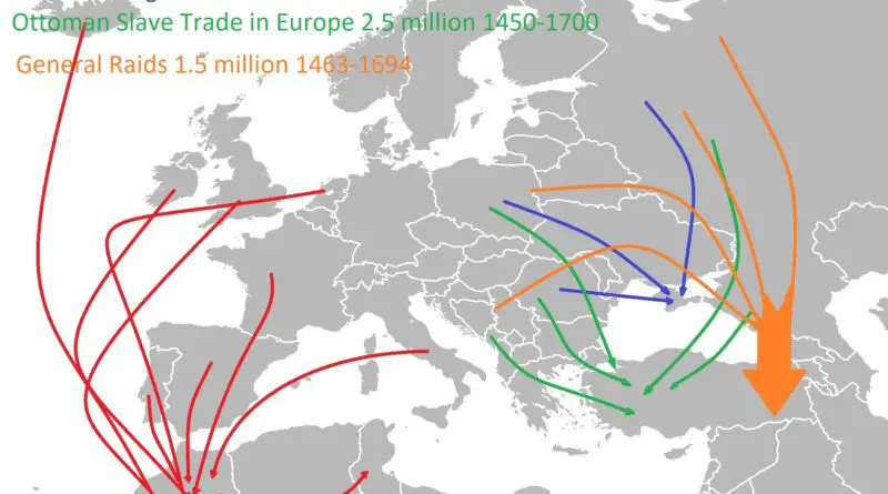
While the transatlantic slave trade is well known, few people realize that millions of Europeans were enslaved between the 15th and 19th centuries. From Barbary pirates to Ottoman slave markets, these trades reshaped Europe in ways that still echo today.
Read More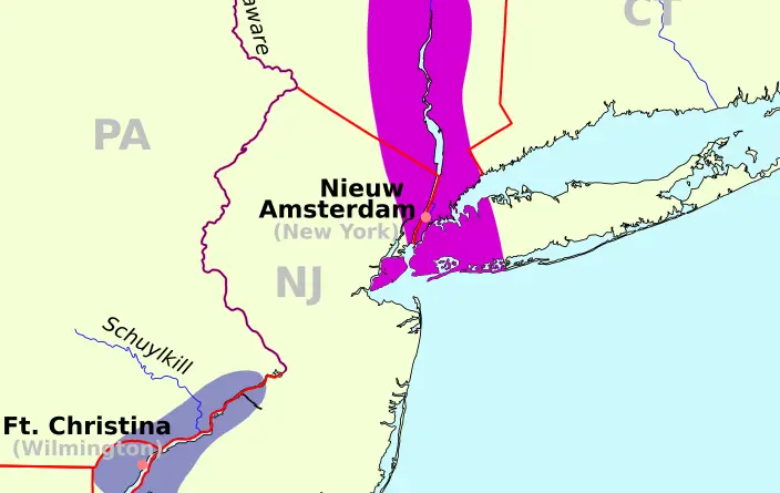
Parts of what would become the eastern United States were ruled by two lesser-known European powers in the middle of the 17th century. Early American history was significantly shaped by the Dutch colony of New Netherland, which was centered on New Amsterdam (now New York City), and the Nordic outpost of New Sweden, which was located at the mouth of the Delaware River. Despite their brief period of independence, they have had a lasting impact on American architecture, language, and culture.
Read More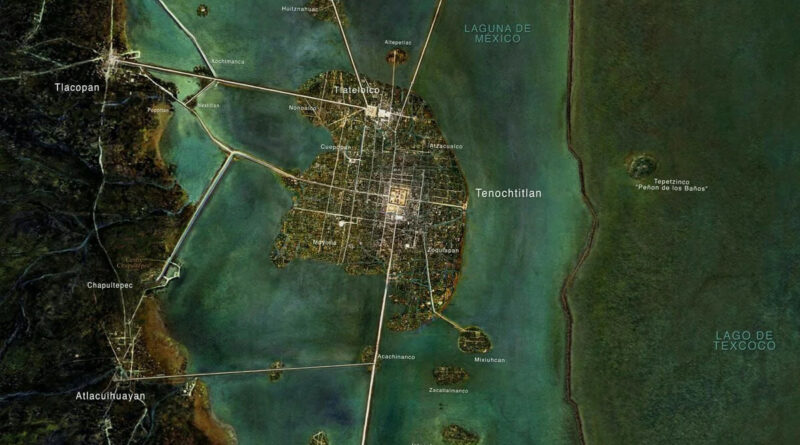
Tenochtitlan, the capital of the Aztec Empire, was a magnificent and advanced city in the 14th century. Situated on an island in Lake Texcoco in the Valley of Mexico, the city was known for its impressive architecture, complex network of canals and causeways, and thriving markets. The layout of Tenochtitlan featured wide avenues and canals, making it a unique urban center of its time. At its heart stood the Templo Mayor, a massive pyramid dedicated to the god Huitzilopochtli, adorned with intricate stone carvings and sculptures. Nearby was the Templo de Tlaloc, honoring the rain god Tlaloc.
Read More