Historical Maps
Historical maps showing territorial changes of countries and historical events of the past.
The Portuguese Empire at its maximum extent
The Portuguese Empire, also known as the Portuguese Overseas, was the 1st Global Empire in History, starting in 1415 with the conquest of Ceuta, over 500 years after Portugal’s foundation in 868. In addition, it was the longest-lived of the modern European colonial empires, spanning nearly six centuries, making it the most extended Global Empire in History.
Read More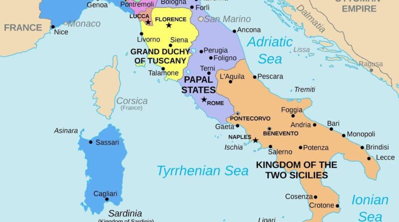
How a Divided Peninsula Became Italy in Just 11 Years
Italy transformed from separate kingdoms into one nation between 1859-1870. Cavour allied with France to defeat Austria. Garibaldi sailed to Sicily with 1,000 Red Shirts and conquered the south. Rome joined in 1870 when French troops withdrew.
Read MorePeep that historical unification of the borough known as Brooklyn
Via brooklynbrewery
Read More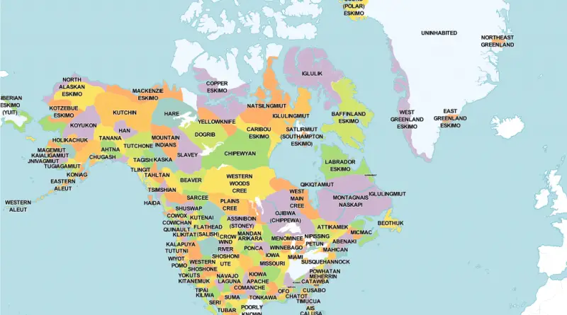
Native Tribes of North America Mapped
The ancestors of living Native Americans arrived in North America about 15 thousand years ago. A wide diversity of communities, societies, and cultures finally developed. At one time numbering in the millions, the native peoples spoke close to 4,000 languages.
Read More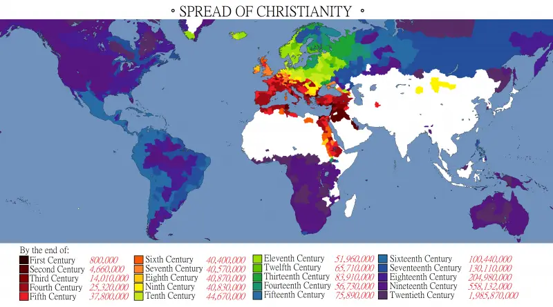
Spread Of Christianity
Christianity originated in the province of Judea out of Jewish culture in the mid-1st century AD, expanded within the Roman Empire. As Christianity became distanced from its Jewish origins, it began to include elements of other cultures and forms of thinking.
Read More