NYC real property inventory report (1934)
“Graphic presentation of data” from the 1934 Real Property Inventory Report, published by LaGuardia’s Committee on City Planning, depicting the
Read More“Graphic presentation of data” from the 1934 Real Property Inventory Report, published by LaGuardia’s Committee on City Planning, depicting the
Read MoreDiscover the captivating cartographic representations that illustrate the dynamic history of modern Greece, from its path to independence to its shifting borders over the centuries.
Read MoreRelated post: – Buried ships along San Francisco`s waterfront
Read MoreRelated post: – Buried ships along San Francisco`s waterfront
Read More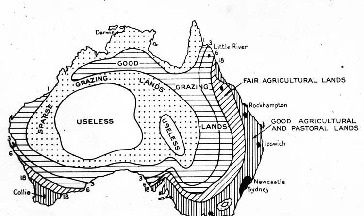
Australia’s climate has always posed challenges – from the arid interior that baffled settlers to today’s rising heat and shifting rainfall.
Read MoreU.S. Census maps from 1790-1861 list enslaved population percentages by county, topping 70% in many Mississippi River and South Carolina/Georgia coastal spots by 1860.
Read More