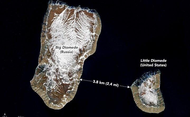
Russia Is Only 2.4 Miles from the United States
Think Russia and the USA are half a world apart? Not quite. In the Bering Strait, two islands prove these superpowers are actually neighbors. The gap between them is just 2.4 miles (3.8 km).
Read MorePolitical Maps show governmental and administrative borders of countries, provinces, states, and counties, the location of major cities, and other political units.
Think Russia and the USA are half a world apart? Not quite. In the Bering Strait, two islands prove these superpowers are actually neighbors. The gap between them is just 2.4 miles (3.8 km).
Read More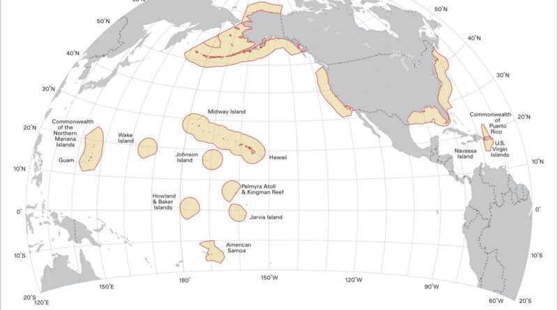
The beach isn’t where America ends. Underwater, the continental shelf extends for miles, and the U.S. has jurisdiction over 5 million square miles of ocean floor. This includes everything from Alaska’s Arctic waters to small Pacific islands that were claimed in the 1850s because of bird droppings.
Read More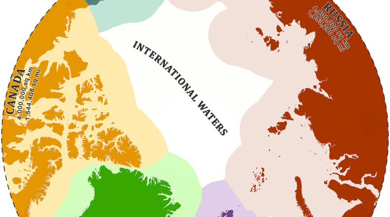
Six countries are staking claims to Arctic waters as ice disappears. Russia leads with 4.8 million square kilometers (1.85 million square miles), Canada has 4 million square kilometers (1.54 million square miles), Denmark claims 2.2 million square kilometers (843,345 square miles) through Greenland. What’s beneath the melting ice makes these claims worth fighting over.
Read More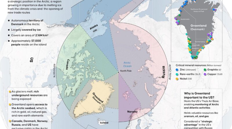
A remote island with just 57,000 inhabitants is becoming a focal point for global competition. Greenland’s retreating glaciers are exposing massive mineral deposits including rare-earths that China currently dominates. Meanwhile, new Arctic shipping routes and strategic military positioning make this Danish territory increasingly valuable to major powers.
Read More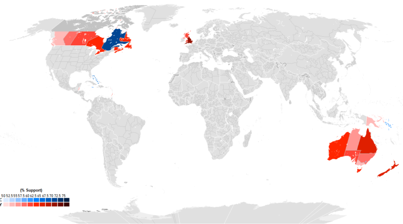
Recent polling from 15 Commonwealth realms shows huge differences in how people view having King Charles III as head of state. England leads at 76% monarchy support, with Tuvalu second at 73%. Quebec goes 70% for a republic, standing apart from other Canadian provinces. The Bahamas hits 65% republican sentiment, Jamaica 55%. Australia’s Capital Territory is the only part of that country preferring a republic at 59%. Caribbean nations cite colonial history as a major factor in their views.
Read More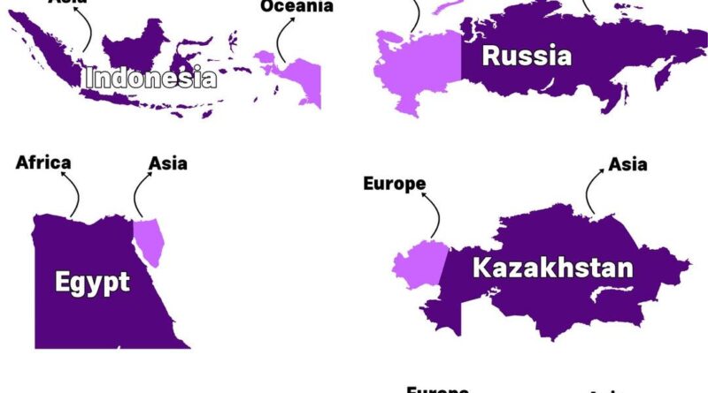
Russia is the obvious choice when thinking about countries that span two continents. But did you know Indonesia also qualifies? Or that Panama connects North and South America?
Read More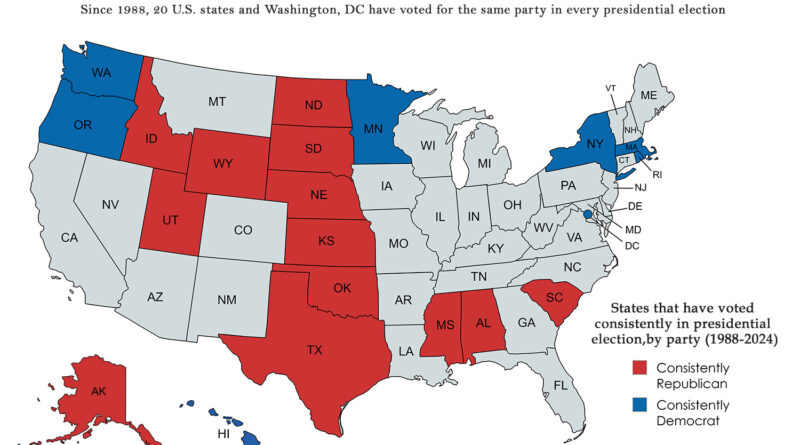
While swing states dominate election coverage, there’s another electoral geography worth examining. Twenty states and Washington, DC have remained remarkably consistent in their presidential voting patterns since 1988, creating a stable foundation beneath the shifting political landscape. Which states have never wavered, and what does their geographical distribution tell us about American political geography?
Read More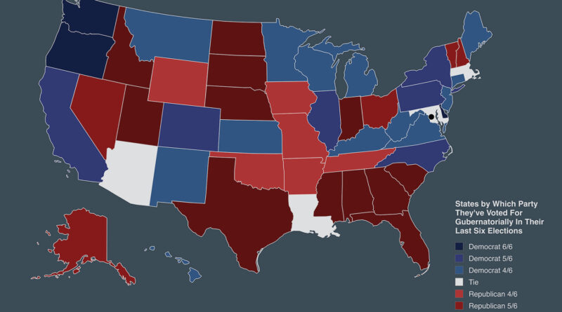
US states with Democratic or Republican governor wins over last six elections: Washington all six Democratic, Texas all six Republican, Arizona even three each, plus regional trends and surprises like Kansas four Democratic.
Read More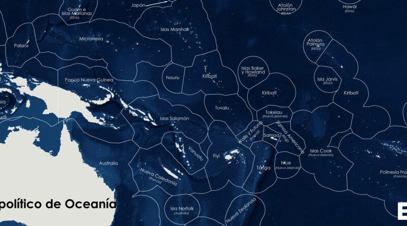
A political map of Oceania shows the region’s vast Exclusive Economic Zones, where small island states like French Polynesia, Micronesia, and the Marshall Islands control huge ocean territories.
Read More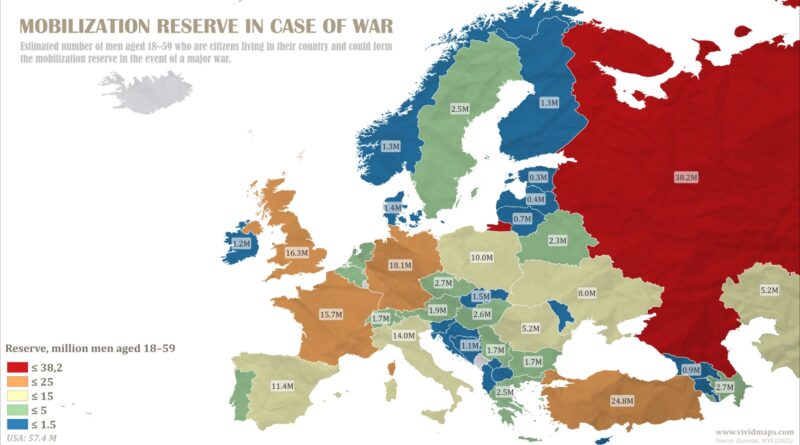
Russia leads Europe with 38.2 million men aged 18-59 in mobilization reserve, but survey data shows only 84% would actually fight. Belgium has the lowest willingness at 19%, while Norway tops the chart at 92%.
Read More