Candidates Need 270 Electoral Votes to Win
Results may fluctuate throughout the day. Votings ends on November 4th, 2016 Source: www.vote.studiesweekly.com
Read MorePolitical Maps show governmental and administrative borders of countries, provinces, states, and counties, the location of major cities, and other political units.
Results may fluctuate throughout the day. Votings ends on November 4th, 2016 Source: www.vote.studiesweekly.com
Read MoreMexican foreign born non-naturalized and Donald Trump’s share of total primary votes, per county Imports from Mexico and Donald Trump’s
Read MoreVia fivethirtyeight.com
Read More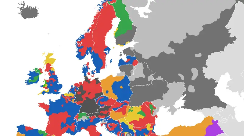
Alexandr Trubetskoy (www.ispol.com) Related post: – Active separatist movements in Europe
Read More
Related posts: – Active separatist movements in Europe – Voting Divisions in Europe (official color of dominant coalition/party shown)
Read More
Imagine a Europe of microstates: Catalonia, Alba, Breizh, and beyond. This post explores regional independence movements and their potential to reshape Europe’s political map.
Read MoreThe History of the World. Since 200,000 BCE, humanity has spread around globe and enacted huge change upon the planet.
Read More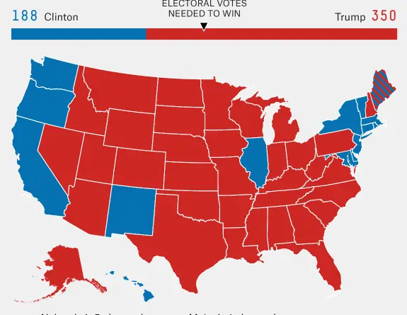
Via bigthink.com
Read More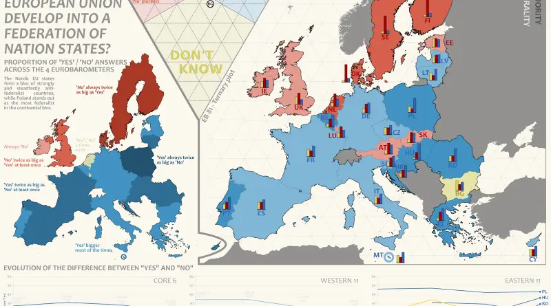
– The Nordic EU states form a bloc of strongly and steadfastly antifederalist countries, while Poland and Hungary stands out
Read More