A New Yorker’s Idea of the United States of America
Wallingford made New York visually dominant to show how the city functioned as the country’s economic, cultural, and social hub for its residents in the 1930s.
Read MoreWallingford made New York visually dominant to show how the city functioned as the country’s economic, cultural, and social hub for its residents in the 1930s.
Read More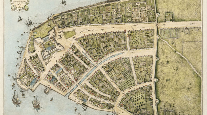
Manhattan below City Hall is 50% larger than in the 1620s. Maps show the Heere Gracht canal (1626-1676), English water lots that added 500 acres by 1776, Castle Clinton built 300 feet offshore in 1808, Egbert Viele’s 1865 map showing landfill extent, Battery Park City’s 92 acres from World Trade Center excavation (1968-1976), and T. Kennard Thomson’s 1911 plan to dam the East River.
Read More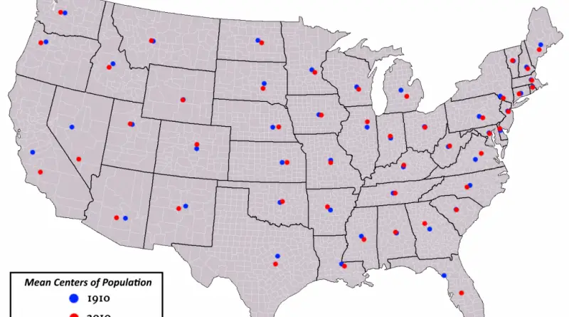
Most U.S. states have seen their population centers shift over the past century. California’s center is now closer to its southern coast and Bay Area than it was in the 1900s. Texas moved southeast as its big cities expanded. Florida’s center went south down the peninsula. Arizona’s shifted toward Phoenix. New Mexico’s moved toward Albuquerque. A handful of states like Wyoming, Vermont, and Rhode Island have barely budged from where they started.
Read More
Reddit user: Shitmemery Only four states haven’t elected a Democrat in the last ~40 years: -The most recent Democrat to
Read More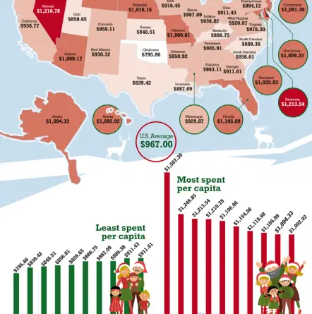
www.titlemax.com Most spent per capita 1.New Hampshire – $1,567.39 2. Vermont – $1,249.85 3. Delaware – $1,213.54 4. Nevada –
Read MoreBetween 1378 and 1417, three men simultaneously claimed to be pope. European kingdoms divided over allegiances to Rome, Avignon, and Pisa, driven purely by political interests rather than religious disagreements.
Read MoreThe Tory Atlas is a map plastered with nicknames instead of country names, showing how British conservatism colored attitudes towards the rest of the world.
Read More
Since 2006, Florida has recorded 94 lightning deaths, more than any other US state. Texas has 41 fatalities, Colorado 25. Men account for 80% of victims, with fishing and boating being the deadliest activities.
Read More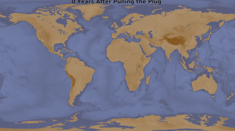
An animated map shows what would happen if you pulled a 10-meter plug in the Mariana Trench. Over 158,180 years, the Atlantic and Indian Oceans become landlocked while the Pacific keeps draining toward the deepest point on Earth.
Read More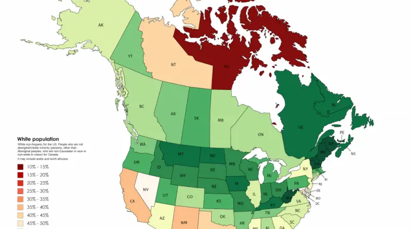
New Brunswick 90.16%, Vermont 89.3%, West Virginia 89.14%. Atlantic Canadian provinces and rural American states have the highest white population shares in North America. Post-1970s immigration concentrated in Toronto, Vancouver, and major U.S. gateway cities, leaving these regions demographically unchanged.
Read More