Mapping Stereotypes

Stereotype maps of Mexico

Mexico is a nation in the southern part of North America. The country is bordered to the north by the U.S., to the southeast by Belize and Guatemala, Belize. Mexico covers almost 2 million square kilometers (~762 thousand sq mi). It has nearly 130 million residents, making it the thirteenth largest nation by area, tenth-most-populous nation, and most populated Spanish-speaking country. It is a federation including 31 states and Mexico City.

Read More
Historical Maps

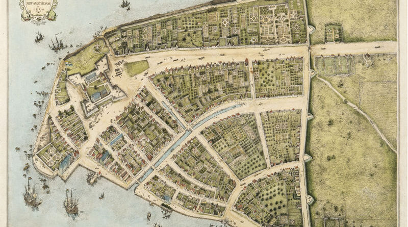
The Changing Shoreline of New York City

Manhattan below City Hall is 50% larger than in the 1620s. Maps show the Heere Gracht canal (1626-1676), English water lots that added 500 acres by 1776, Castle Clinton built 300 feet offshore in 1808, Egbert Viele’s 1865 map showing landfill extent, Battery Park City’s 92 acres from World Trade Center excavation (1968-1976), and T. Kennard Thomson’s 1911 plan to dam the East River.

Read More