What thetruesize.com really does
Using thetruesize.com it is apparent that Argentina, compared to Europe, is larger than many had thought. Especially the nothern part
Read More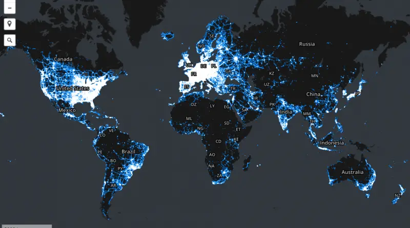
Areas in which our stumbling community has collected data samples
The interactive map below shows general areas for which we have data samples. It does not show the locations of
Read MoreRelief map of the British Isles
Reddit user: AJgloe
Read MoreJapanese Pictorial World Map, 1932
Japanese pictoral map, showing what were the national stereotypes at the time
Read More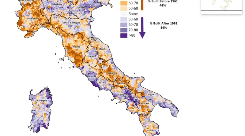
Italy’s Housing Landscape: The Pre- and Post-1961 Building Boom
A striking visualization reveals the patterns of Italy’s residential development, showing which communities preserved their historic buildings and which underwent massive modern expansion after 1961 – a key year that marked the peak of Italy’s economic miracle.
Read More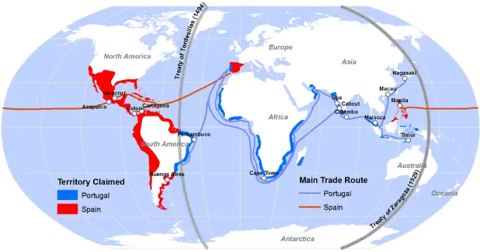
Territory claimed by Spain and Portugal due to Treaties of Tordesillas and Zaragoza
Reddit user: ThorPL123
Read More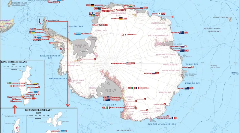
Humans in Antarctica
Credit: Seweryn Szeliga Antarctica has no permanent residents, although it contains research stations and field camps that are staffed seasonally
Read MoreMap showing the relative size of each of the United States if based on Electrical energy sold for light and power (1921)
“Relative size of each of the United States if based on electrical energy sold for light and power in 1921
Read More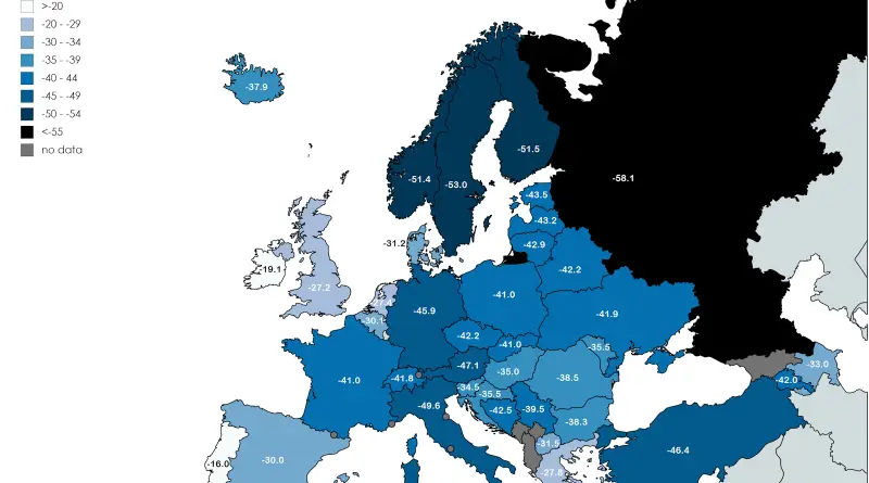
Coldest temperature recorded in each country in Europe
Reddit user: Jeleki Related post: – Find cities with similar climate
Read More