Stereotypical Map of New Zealand (2017)
Reddit user: jej_supreme
Read More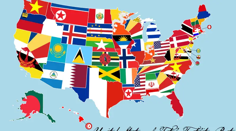
Fertility rates in the United States mapped
The American birth rate dropped for the 6th sequential year in 2020, with the lowest amount of children born since 1979. The drop in birth rates was observed among all observed racial groups.
Read More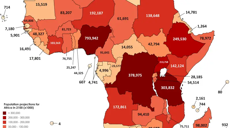
UN Population projections for Africa in the year 2100
Reddit user: SwiftOryx
Read More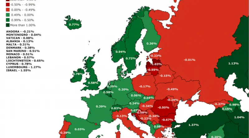
Average annual rate of population change %
The 2017 Revision of World Population Prospects is the twenty-fifth round of official United Nations population estimates and projections that
Read MoreParts of US that most resemble the future
The bureau on Thursday published its latest detailed population estimates for each of the more than 3,000 American counties. Sioux
Read MoreAverage Annual High Temperature vs. Climate Normal High Temperature
In Alaska, if all variables fall into place, the days near the solstice often produce the warmest temperatures several weeks
Read MoreThe most impactful invention by U.S. state
It may seem as if we are regularly bombarded with inspiring innovations and discoveries in our contemporary times. Still, many new ideas and technologies forming our current world can frequently be traced back centuries in their origins.
Read More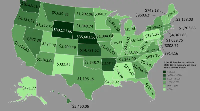
The richest person in every U.S. state, by industry
8 billionaires made fortunes in finance and 8 in retail. Nick DeSantis, www.forbes.com Richest In State list, Frank VanderSloot of
Read MoreRates of Persons Living with Diagnosed HIV
– Southern States Experience the Greatest Burden of Infection and Deaths: The Southern U.S. is home to nearly 37 percent of
Read More