The Most Famous Band of all Time From Every U.S. State
As the country that invented rock n’ roll, the United States has produced more than its share of famous bands.
Read More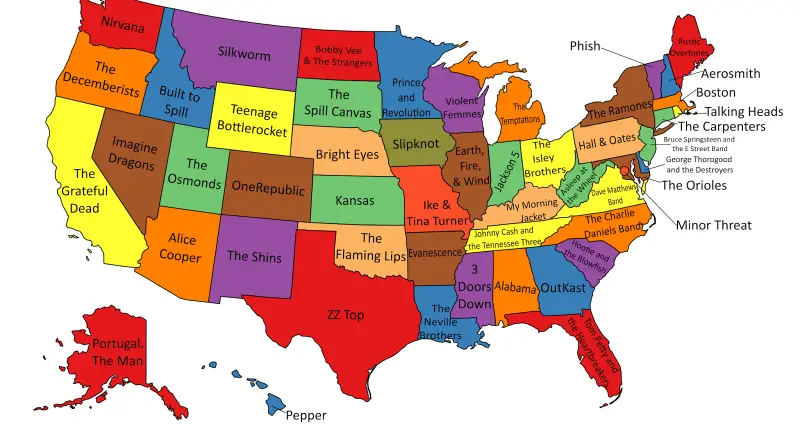
As the country that invented rock n’ roll, the United States has produced more than its share of famous bands.
Read MoreLead exposure varies in neighborhoods across the most populous U.S. county. In at least 323 census tracts, more than 5
Read MoreIn Los Angeles, one life is lost every 40 hours from traffic deaths. 260 lives were lost in 2016. Every
Read More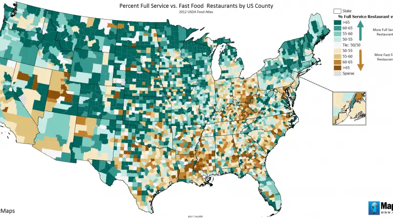
More than one million restaurant locations in the United States, employing almost 15 million workers; 101,811 of them in 2021 were chain restaurants. Because of the pandemic, the total restaurant sales were just $565 billion, which is $334.2 billion less than the COVID-19 pandemic prediction.
Read Morewww.bldgblog.com 1. Living Cost DifferentialThis line relates to Urbanism and Resources. 2. Task Force LineThis line relates to Mobility and
Read More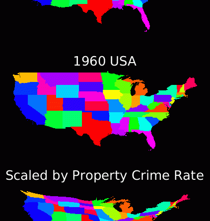
Cartogram generated by running the diffusion equation until crime rate is uniform, and deforming the map with the resulting flux.
Read More“Population Lines” by Dr James Cheshire. James Cheshire. Data: NASA
Read MoreSource: Geopolitical Futures
Read MoreThe distribution of plants in a perpendicular direction in the torrid, temperate and frigid zones, with indications of the mean
Read More
Reddit user: sendherhome22
Read More