The world according to the Dutch
Reddit user: Inspirationguy
Read More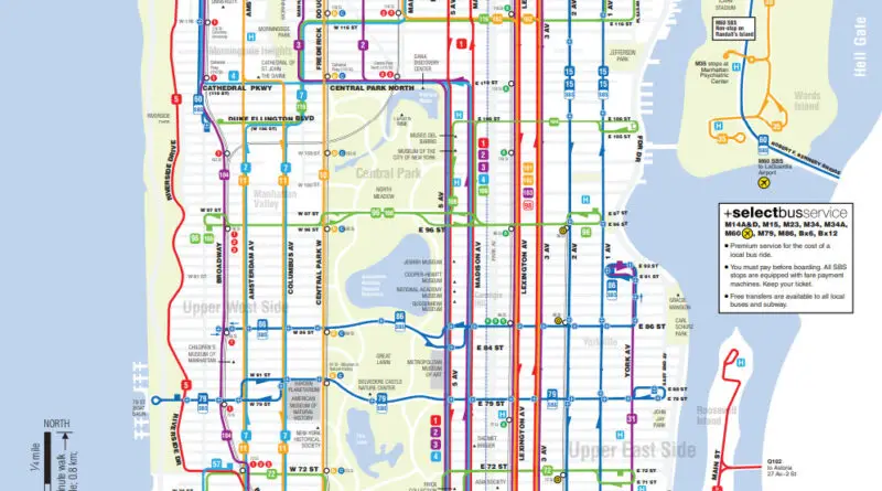
New York City Transportation Accessibility: Navigating the Urban Jungle
Dive into the complex world of New York City’s transportation system. From subway-only commutes to the impact of bus routes, uncover how different modes of transit affect accessibility across the city’s diverse neighborhoods. Explore interactive maps and borough-specific commuting data to gain insights into navigating the urban landscape of the Big Apple.
Read MoreManhattan in 3D
Experience lower Manhattan in a whole new way with a new interactive 3D map. Related posts: – How tall will new
Read MoreBasketball viewership: College vs Professional
The comparative popularity of men’s college basketball & men’s professional basketball. Via adventuresinmapping.com
Read More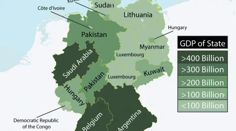
States of Germany as Countries with Similar GDPs
Source: imgur.com
Read MoreThe most and least educated U.S. states
Education in the U.S. is provided in public and private schools. State governments set general educational standards, often requiring standardized tests for K–12 public school systems. Compulsory education is split into three levels: elementary, middle or junior high, and high school.
Read MoreThe Best and worst U.S. states to retire
Source: Business Insider WalletHub compared the 50 U.S. states and Washington, DC across three categories. Affordability, quality of life, and health
Read More