A British map of New York City (1776)
“A Plan of the City and Environs of New York in North America.” Related posts: – Interactive map of New
Read More“A Plan of the City and Environs of New York in North America.” Related posts: – Interactive map of New
Read MoreThe map depicts Asia, Africa & Europe.
Read More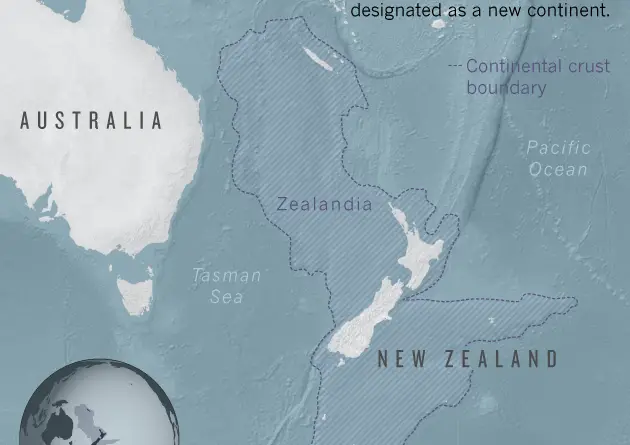
Geophysical data suggest that a region spanning 5 million square kilometers, which includes New Zealand and New Caledonia, is a
Read MorePicture: Reddit / Speech500 Related posts: – A face made from North American Governors & Premiers – A Face made
Read More
Related posts: – NYC by equivalent state population – ALSO an area in the U.S. with equivalent population of NYC
Read MoreNet migration rate is the difference of immigrants & emigrants of an area in a period of time, divided per
Read MoreRed color: Iraq government Black color: ISIS
Read More
Picture: Reddit (BuddyWudd)
Read MorePicture: Reddit / reschultzed
Read More