Mapping the World’s Facebook friendships
Rankings between countries are based on the number of Facebook friendships between countries and the total number of Facebook friendships
Read MoreRankings between countries are based on the number of Facebook friendships between countries and the total number of Facebook friendships
Read MoreRelative value of $100 based on National Average Via economist.com Related post: – The relative value of $100: Which state
Read More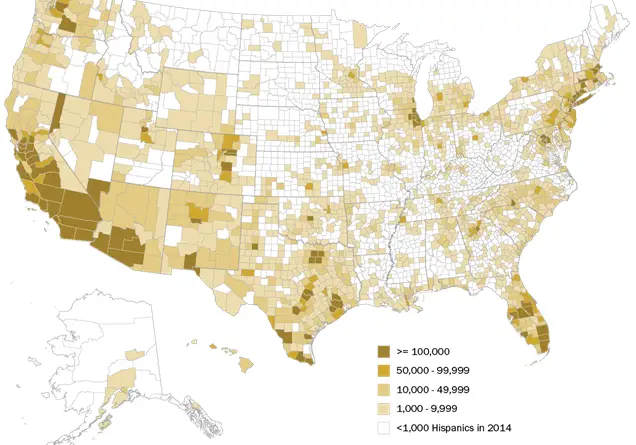
Via pewresearch Related posts: – U.S. population by race – U.S. Hispanic population, percent increase by county – U.S. Hispanic
Read More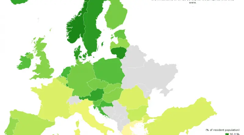
Satisfaction with life in EU capital cities (2015) Inhabitants of Vilnius most satisfied with life in their city, inhabitants of
Read MoreThis map is the climate map used by folks installing heating and air conditioning, to best estimate cooling and heating
Read More
The relationship of average temperatures and suicides in Europe. Suicide rates in Europe Related post: – Suicide death rates
Read MoreRelated post: – Voronoi map of the USA
Read MoreA Washington Post-SurveyMonkey poll of all 50 states indicates the 2016 campaign could flip several red and blue states from
Read MoreTerritorial disputes in the South China Sea present an array of potential flashpoints between countries with overlapping claims. In recent
Read More