U.S. Coal Distribution
Between 1980 and 2000, U.S. coal mining productivity increased at an average rate of 6.6% per year, from 1.93 to
Read More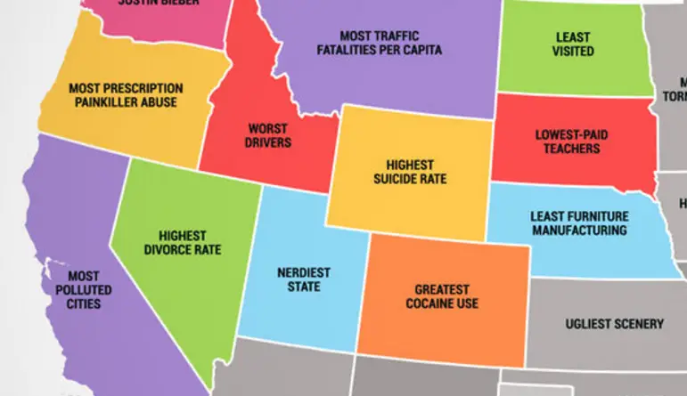
The best of States, the worst of States
What each U.S. state is best at What each U.S. state is worst at What Each EU state is best
Read MoreThis cube superimposed over a map of Manhattan could hold all humans on the planet
A cubic building (side of 1.07km) that could hold all 7.3 billion humans on the planet. The world’s tallest building,
Read More