How Iran’s Borders Changed Over the Past 200 Years
Take a closer look at how Iran’s borders changed over time. This map highlights what the country lost—and why it happened—with historical facts and treaty details that shaped today’s Iran.
Read More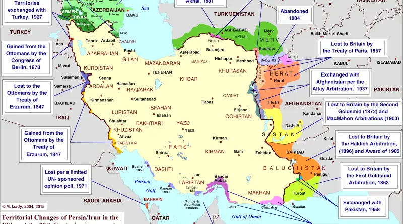
Take a closer look at how Iran’s borders changed over time. This map highlights what the country lost—and why it happened—with historical facts and treaty details that shaped today’s Iran.
Read MoreA refugee is a person who is outside their country of citizenship because they have well-founded grounds for fear of
Read MoreThe Global Diplomacy Index is an interactive web tool which maps and ranks the diplomatic networks of all G20 and
Read MoreRelated posts: – UK ethnicity map (one dot per person) – USA: The racial dot map – Australia: The racial
Read MoreThis map uses open source data, curated by the Carter Center and integrated and analyzed in Palantir, to show how
Read MoreProbe the solar system from Mercury to Pluto with this stellar schematic of space exploration! From the Luna 2 in
Read More
Based on the NOAA’s historical tropical storm tracks data, which includes storms dating as far back as 1850, the map above shows a top-down
Read More