The Free Wi-Fi Map
500,000+ open, public WiFi hotspots. Source: www.meshable.io/map Related posts: – World Wi-Fi Map
Read MoreIconic architecture on Spain’s map
Related posts: – Landscapes (more or less typical) by country
Read MoreWinter 2016: rainfall amount % of 1981-2010 average
This winter has been the wettest on record for Wales, Scotland and Northern Ireland and the second-wettest for the UK
Read More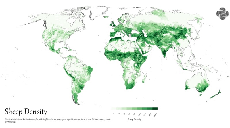
Where in the World Are the Most Sheep?
Explore how sheep are distributed around the world. We’ll look at global population trends, explain the numbers, and share a detailed sheep density world map.
Read MoreLivestock per sq mile in the US
Livestock farming is an important sector of the United States agriculture industry, and the amount of livestock per square mile varies across the country depending on various factors, such as climate, soil quality, and water resources.
Read MoreWorld Radio Map
Radioooo – new fun global music map that allows you to listen to music from anywhere in the World and
Read MoreAtmospheric moisture
The atmosphere contains an enormous amount of moisture that circulates around the globe, shown here in this imagery. However, not
Read More