Historical Maps

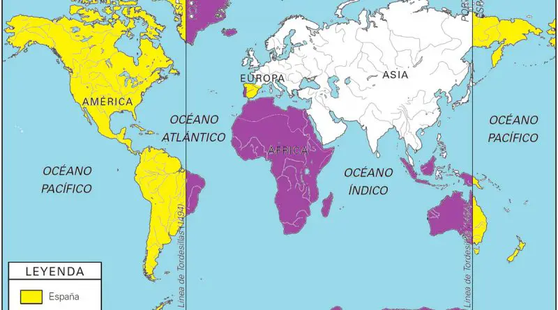
On this day (June 7, 1494), Spain and Portugal divided the world between the two nations

The Treaty of Tordesillas signed at Tordesillas on June 7, 1494, and authenticated at Setúbal, Portugal, divided the newly discovered lands outside Europe between the Portuguese Empire and the Crown of Castile, along with a meridian 370 leagues west of the Cape Verde islands, off the west coast of Africa.

Read more: On this day (June 7, 1494), Spain and Portugal divided the world between the two nations
Economic mapsResources

The Countries With The Largest Gold Reserves Mapped

During the 19th and early 20th century epochs of the gold standard, national governments were obligated to redeem the national currency for a specific quantity of gold. Back then, every nation’s central bank used its gold reserves to meet those commitments, backing some or all of the currency in issue with the gold it owned. Besides, gold reserves were stored by governments to meet the costs of waging war conflicts.

Read more: The Countries With The Largest Gold Reserves Mapped