Spain’s 1588 Plan for China — the Empresa de China
In the 1580s, Spanish officials and missionaries discussed taking control of Ming China, outlining a step-by-step plan.
Read More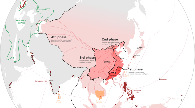
In the 1580s, Spanish officials and missionaries discussed taking control of Ming China, outlining a step-by-step plan.
Read More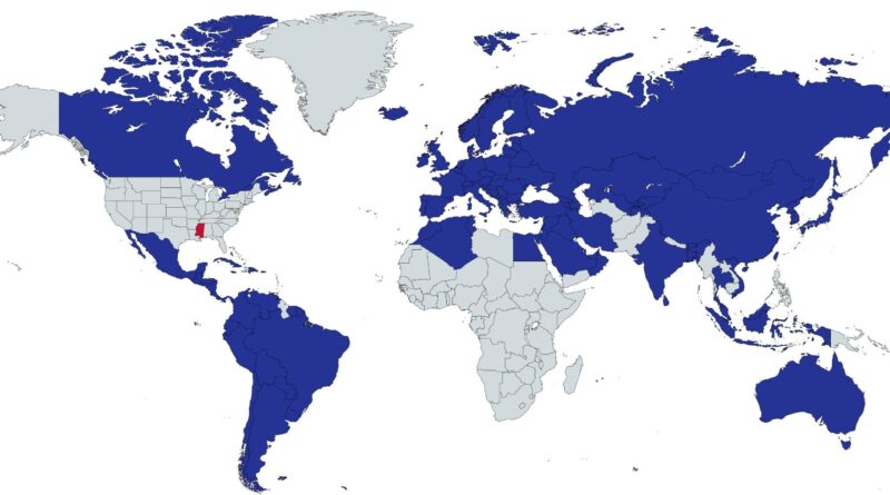
How does the poorest U.S. state look next to nations around the world? Life expectancy, HDI, and GDP per person show some unexpected contrasts.
Read More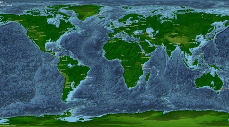
Earth’s seas are rising today, but the long-term future holds both floods and droughts on a planetary scale. See maps I created showing what our world would look like if all ice melted, if alien oceans were added, and when Earth eventually runs dry.
Read More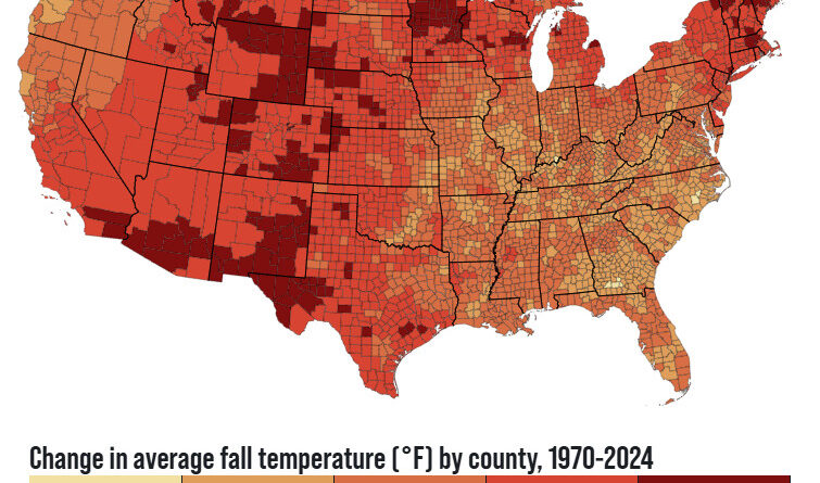
Remember when October actually felt cool? Those days are fading. New climate data reveals every US county now has warmer falls than in 1970. The Southwest saw the biggest jumps – Reno warmed by 7.7°F (4.3°C). Explore interactive maps to see exactly how much your area changed.
Read More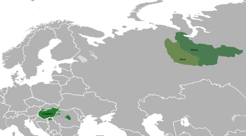
Walk through Budapest and you’ll hear a language unlike any of its European neighbors. Hungarian belongs to the Ugric branch of the Uralic family, but its closest relatives aren’t nearby—they’re way over in western Siberia.
Read More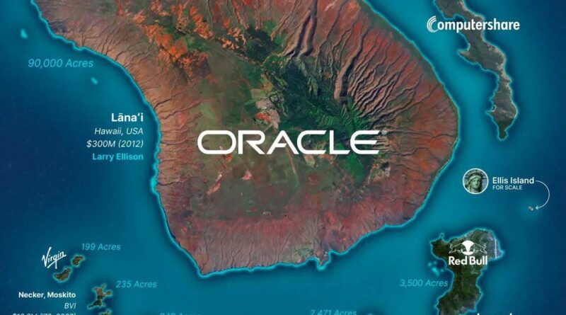
The wealthiest don’t stop at owning vast ranches – they buy entire islands. This post maps and compares billionaire islands around the world, with sizes, costs, and owners side by side.
Read More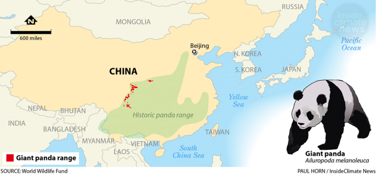
A map comparing the historic and current range of the giant panda shows how much its world has shrunk.
Read More
Written around 150 CE, Ptolemy’s Geographia listed about 8,000 places with coordinates. The European entries show us how ancient geographers understood their world—a window into early efforts to map and organize geographical knowledge.
Read More
The “evil eye” is one of the world’s oldest superstitions. Here’s where it’s still believed, how people try to protect themselves, and why it’s fading in wealthier nations.
Read More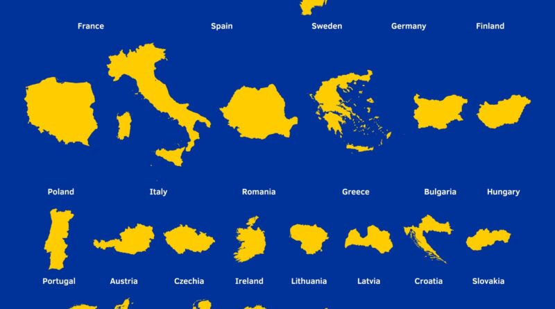
France could fit Malta inside it 1,733 times. This map ranks all EU countries from biggest to smallest with their actual sizes and population densities.
Read More