The 24 states of Australia: if all statehood proposals had been accepted
Proposals for new Australian states have been many since the late 18th and early 20th centuries. The late 1800s witnessed
Read More
Proposals for new Australian states have been many since the late 18th and early 20th centuries. The late 1800s witnessed
Read More
The first ship and team mapped the Australian shoreline were the Duyfken captained by Dutch explorer Willem Janszoon. He sighted the Cape York Peninsula shore in early 1606. William Dampier, an English explorer, landed on the north-west shoreline of New Holland in 1688. In 1770, James Cook cruised along and mapped the east coast, which he called New South Wales, and claimed Great Britain.
Read More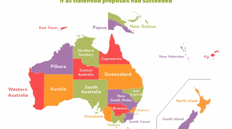
Reddit user: AJgloe
Read More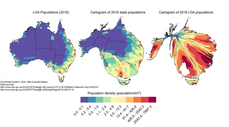
Australia’s population tells a compelling story of coastal congregation and inland space. With just 3 people per square kilometer, this vast continent demonstrates one of the world’s most striking examples of population concentration, as revealed through these fascinating maps and data.
Read MoreReddit user: Yourdadgivesgoodhead
Read MoreThis video will map the entire history of Australia and the Pacific Islands, known collectively as Oceania. Due to a
Read MoreMelbourne is striving to become a world-class liveable city. Great cities are great places to walk around. Are there road
Read More. Vegetation map by Griffith Taylor, 1929
Read More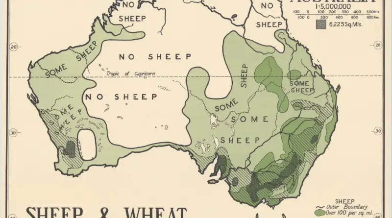
Picture: Reddit / Speech500 Related posts: – A face made from North American Governors & Premiers – A Face made
Read More