Dutch general election results by Municipality (March, 2017)
Source: nw12398 The parties who won seats are as follows: VVD (Volkspartij voor Vrijheid and Democratie – People’s Party for
Read MoreSource: nw12398 The parties who won seats are as follows: VVD (Volkspartij voor Vrijheid and Democratie – People’s Party for
Read MoreReddit user: Inspirationguy
Read More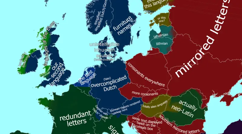
In 1800, the largest colonial empires were the British Empire and the Spanish Empire. The British Empire controlled territories in the Americas, Africa, Asia, and Oceania, while the Spanish Empire had extensive holdings in the Americas, including most of South America, Central America, and Mexico, as well as the Philippines in Asia.
Read MoreThe Dutch stereotype map of Europe. Victor Van www.werkhooven.nl
Read More
The Netherlands means “lower countries” about its low elevation and flat topography, with just approximately 50 percent of its land topping 1 meter (3 feet 3 inches) above sea level and almost 26 percent descending under sea level. The most culmination of the territories below sea level, known as polders, is land reclamation in the 14th century.
Read More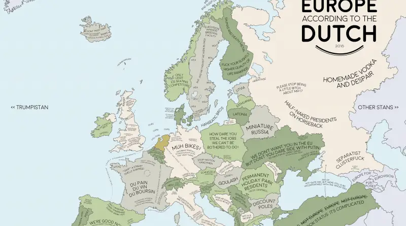
Dutch a Germanic ethnic group native to the Netherlands. The Dutch are frequently perceived as the pioneers of capitalism, and their importance on a contemporary economy, secularism, and a free market have been hugely influential worldwide. It affects the Dutch perception of other countries of the world.
Read MoreReddit user: goeie-ouwe-henk
Read More