North America

NewsVivid mapsWater Bodies

Maps of the Great Lakes

The Great Lakes are the most extensive freshwater system globally (94,600 sq mi / 244,000 sq km). The Lakes contain 5,400 cu mi (22,500 cu km) of surface freshwater on earth or 6 quadrillion gallons of freshwater (22.7 quadrillion liters), accounting for about 21% of the world’s surface freshwater or 84% of North America’s surface freshwater.

Using Digital Elevation Model data, I made the map of the Great Lakes in watercolor style.

Read More
Environment maps

Tree Height Maps

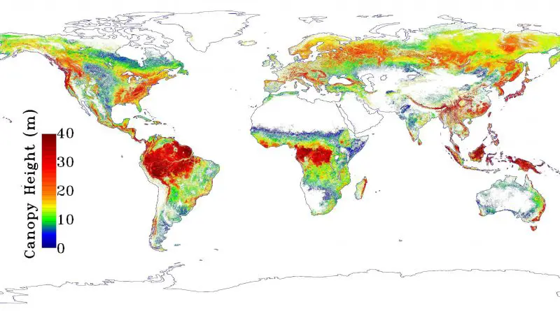
According to the map, forest heights decrease at a higher elevation and are highest at low latitudes, decreasing in height the farther they are from the tropics (except 40° south latitude in southern temperate rainforests in Australia and New Zealand). Moreover, the highest forests are concentrated in mountain areas.

Read More