
United States
Maps of the US
NASA Maps Show How Fast New Orleans Is Sinking
Using NASA airborne radar, scientists have shown the degree to which New Orleans and its surrounding areas are sinking each
Read More
Hawaii Island Climate Zones
Sixty miles (97 km) separates Hilo’s 130 inches (3,302 mm) of annual rain from the Kohala coast’s under 10 inches (254 mm). Both are on the same island. The Big Island of Hawaii has 10 of the world’s 14 Köppen climate zones in 4,028 square miles (10,430 km²), from tropical rainforest to periglacial desert at the summit of Mauna Kea.
Read MoreAfro-American Travel Map (1942)
A guide for negro hotels and guest houses in the eastern USA.
Read More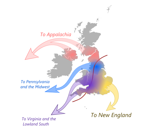
Four British Migrations That Shaped America
Massachusetts doesn’t feel like Virginia for a reason. Between 1620 and 1770, four British regions sent settlers with completely different worldviews. East Anglian Puritans built communal New England. North Midlands Quakers created tolerant Pennsylvania. Southern English gentry ran hierarchical Virginia. Scottish-English borderers settled independent Appalachia. The map shows where they came from and where they went. American regions still reflect those origins.
Read More50 biggest U.S. cities ranked by the geographic diversity of their populations
According to seattletimes.com Among the 50 biggest U.S. cities, Seattle ranks No. 3 on the “geographic diversity index” with a
Read More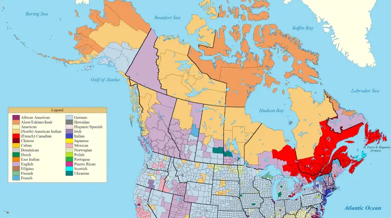
Dominant Ancestry Map of the US and Canada
Germans cover the Midwest—41 million Americans. Wisconsin 37% German, North Dakota 36%, some counties hit 64%. Mexicans cluster along the border at 11% of Americans. African Americans dominate where plantations were. English ancestry leads Appalachia and BC. French fills Quebec and northern Maine. Montana is German, southern Saskatchewan is German. But Washington is German and British Columbia is English. Settlement timing and colonial policies created these patterns that persist today.
Read More