Most & least remembered states
Most and least remembered states based on 12 Sporcle responses.
Read MoreMaps of the US
Most and least remembered states based on 12 Sporcle responses.
Read More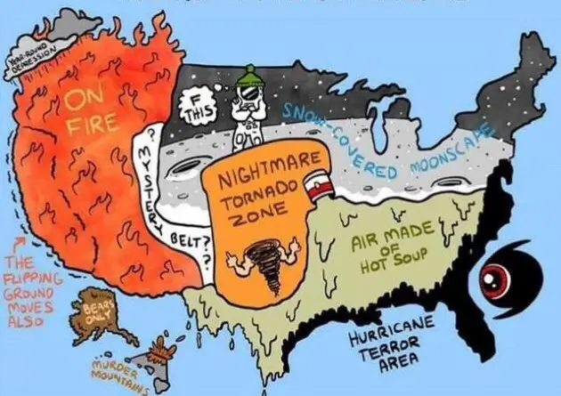
The United States is a diverse country. That’s why many people have a lot of misconceptions about the United States. Atlas of the stereotype maps below shows these misconceptions about different parts of the country.
Read MoreVia metrocosm.com
Read More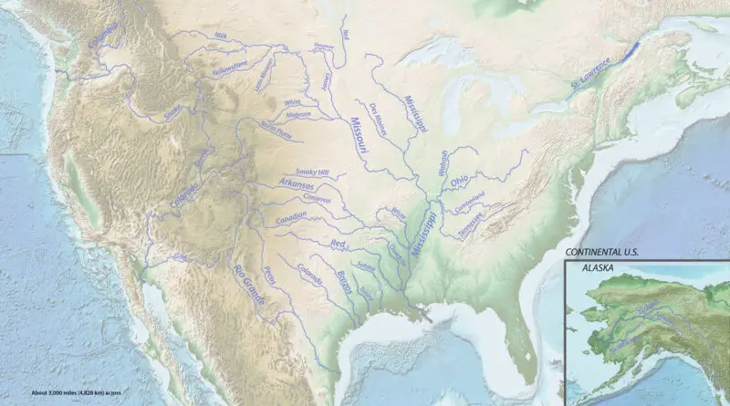
The United States is home to a vast network of rivers, playing a crucial role in the nation’s geography and ecosystems. Major rivers like the Mississippi, Missouri, and Ohio traverse diverse landscapes, influencing agriculture, transportation, and industry. These waterways not only support a variety of ecosystems but also serve as vital sources for irrigation, hydroelectric power, and recreation, contributing significantly to the environmental and economic fabric of the country.
Read MoreVia visual.ly
Read More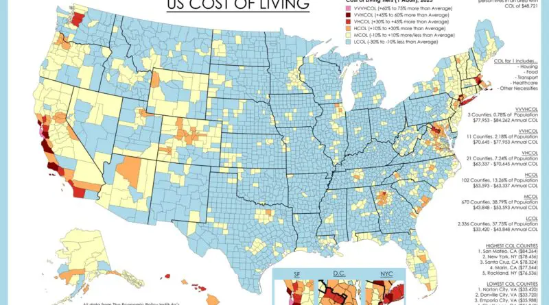
Understanding the cost of living in the United States is crucial for individuals and families alike, whether they are considering a relocation, planning their budget, or simply curious about economic trends. From bustling metropolises to tranquil rural areas, the landscape of expenses varies significantly across the country. In this article, we delve into the factors influencing the cost of living, identify areas where it’s more expensive or cheaper to reside, and explore recent trends shaping these dynamics.
Read MoreVia www.brookings.edu/blogs/the-avenue/posts/2015/10/13-local-data-eitc-benefits-children-kneebone
Read More