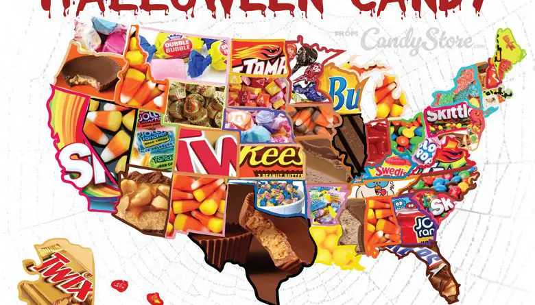
United States

Maps of the US

Transport

United States interstate system mapped

Construction of the Highway System was declared finished in 1992. The cost of the Interstate Highway System’s construction was almost $114 billion (equal to $521 billion in 2020). The primary system has been extended many times by the expansion of being designations and creating new designations. Currently, all routes’ total length is more than 48.4 thousand miles (~78 thousand kilometers).

Read More
Old maps

The Ever-Changing Map of the United States: A Journey Through America’s Protected Lands

From the towering redwoods of California to the sprawling Everglades of Florida, the United States is home to a diverse array of protected lands. This post delves into the fascinating history and current status of National Forests, State Forests, National Parks, and National Monuments, revealing how these vital areas have transformed the map of the United States over the past century.

Read More
Education

Mapping America’s Education Landscape

Dive into the complex world of American education through two revealing maps. One exposes “education deserts” where millions live far from colleges, while another highlights stark differences in school funding across the nation. These visualizations offer a unique perspective on educational access and investment across the United States.

Read More