United States

Maps of the US

Population

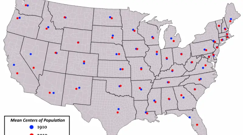
How U.S. State Population Centers Shifted Over a Century

Most U.S. states have seen their population centers shift over the past century. California’s center is now closer to its southern coast and Bay Area than it was in the 1900s. Texas moved southeast as its big cities expanded. Florida’s center went south down the peninsula. Arizona’s shifted toward Phoenix. New Mexico’s moved toward Albuquerque. A handful of states like Wyoming, Vermont, and Rhode Island have barely budged from where they started.

Read More
Transport

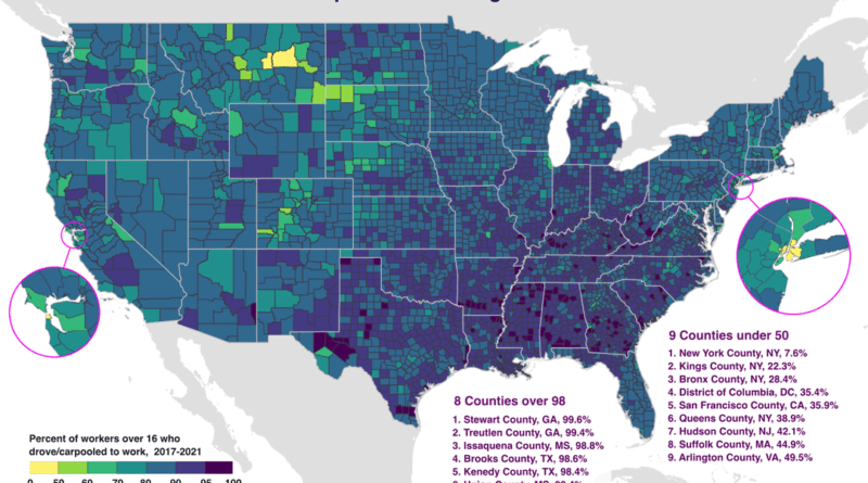
Mapping America’s Car Dependency by County

In Stewart County, Georgia, 99.6% of workers drive to their jobs. In Manhattan, just 7.6% do. This map using Census Bureau data from 2017-2021 shows which American counties are most car-dependent and where alternatives exist. Eight counties exceed 98% driving rates, all in rural areas. Nine counties fall below 50%, concentrated in dense urban centers with transit systems.

Read More