United States

Maps of the US

Historical Maps

Louisiana purchase mapped

The Louisiana Purchase was the purchase of the territory of Louisiana by the U.S. from France in 1803. In return for 15 million dollars (~$18 per square mile), the U.S.obtained 828 thousand square miles or 2.14 million square kilometers. But, in reality, before purchase France only controlled a small part of this territory, mostly inhabited by Native Americans.

Read More
Laws

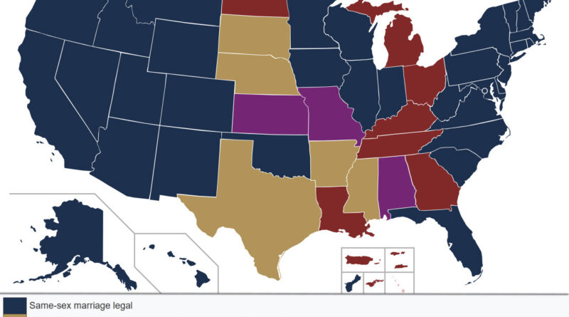
The Geography of Marriage Equality Before Obergefell v. Hodges

When the Supreme Court heard Obergefell v. Hodges in 2015, America’s map of marriage equality looked nothing like the uniform landscape we see today. Some states had recognized same-sex marriages for over a decade. Others held firm to constitutional bans. Between these extremes lay a complex middle ground of legal limbo, stayed court decisions, and jurisdictional uncertainty. Understanding this geography helps us grasp just how fractured the legal landscape had been.

Read More