America’s Coffee Landscape: The Leading Brand in Every State
Starbucks leads in most American states, while Dunkin’ commands IL, VA, and the Northeast. Tim Hortons dominates MI and OH, and Caribou leads six Upper Midwest states.
Read More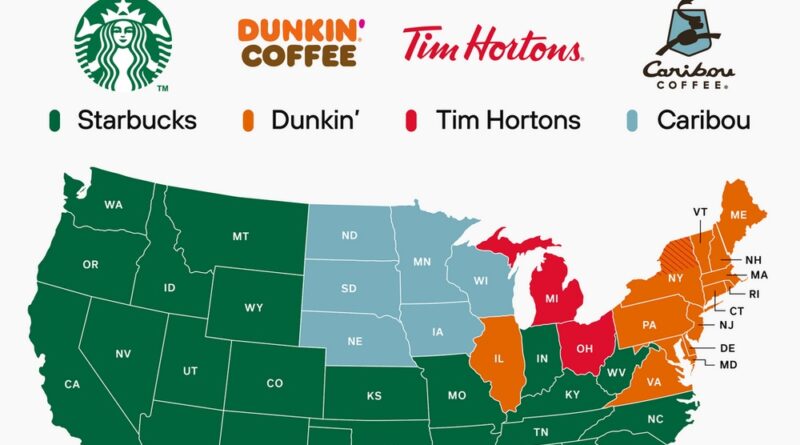
Starbucks leads in most American states, while Dunkin’ commands IL, VA, and the Northeast. Tim Hortons dominates MI and OH, and Caribou leads six Upper Midwest states.
Read More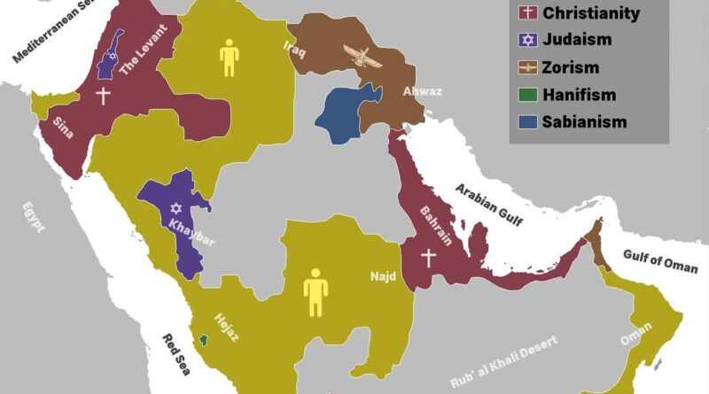
In the early 5th century, different beliefs shared the Arabian Peninsula. Jewish and Christian families lived in busy caravan towns, while many desert tribes still honored local gods or searched for a single creator.
Zoroastrian customs from Persia reached Arabia’s northeast, blending with local traditions. A few generations later, Islam appeared and began to reshape life across the peninsula.
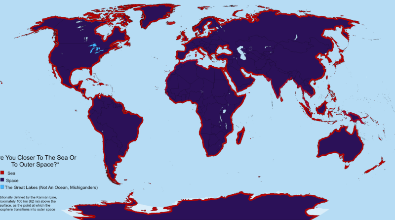
Areas within 100 km (62 mi) of oceans compared to areas closer to the Kármán line where space begins. 99% of atmospheric mass sits below 30 km (19 mi) while Earth measures 12,742 km (7,918 mi) across. Troposphere holds 85-90% of atmospheric mass in just 8-20 km.
Read More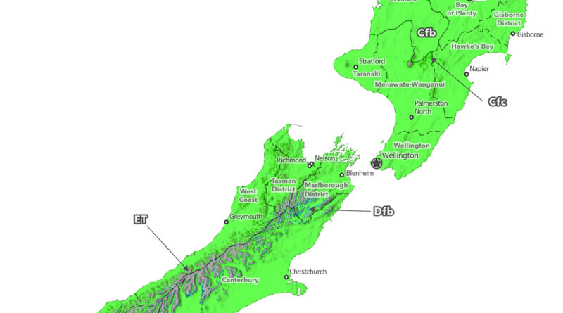
Köppen-Geiger climate maps of New Zealand reveal mountain climate zones disappearing from 1930 to 2099. Cool-summer oceanic climate (Cfc) vanishes from North Island, tundra patches (ET) disappear from Southern Alps peaks, subarctic zones (Dfc) shrink dramatically, and cold steppe (BSk) contracts under ssp2-4.5 scenario.
Read More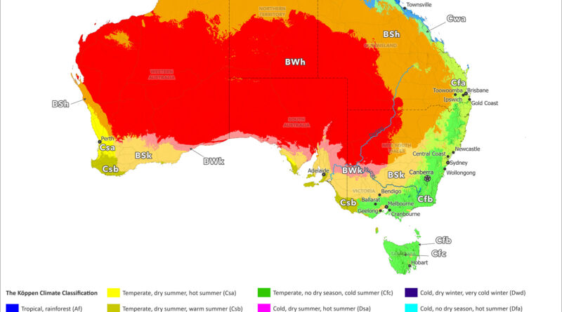
Köppen-Geiger climate maps of Australia reveal desert expansion from 1930 to 2099. Hot desert (BWh) and steppe (Bsh) zones spread hundreds of kilometers toward Sydney, Brisbane, Melbourne, and Perth. Habitable climate zones supporting population centers get compressed coastward under ssp2-4.5 scenario.
Read More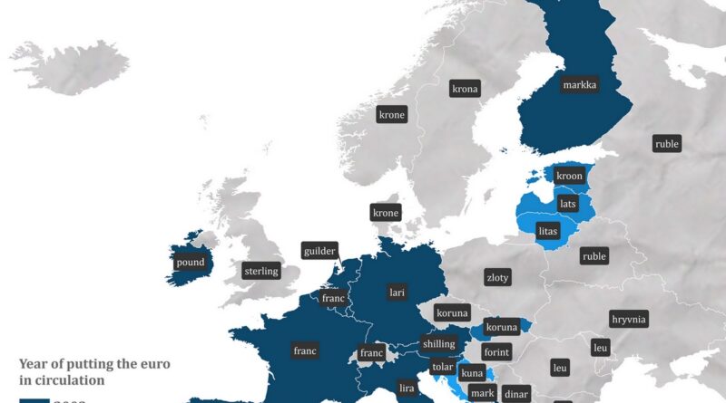
Germany used marks, France used francs, Italy used lira, Spain used pesetas. This map shows the currency each European country used before the euro.
Read More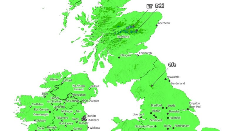
Köppen-Geiger climate maps of the British Isles reveal mountain climate zones disappearing from 1930 to 2099. Tundra patches in the Grampians vanish by the 2070s, extreme cold zones disappear by the 2090s, and the Pennines lose their cool-summer classification entirely under the ssp2-4.5 scenario.
Read More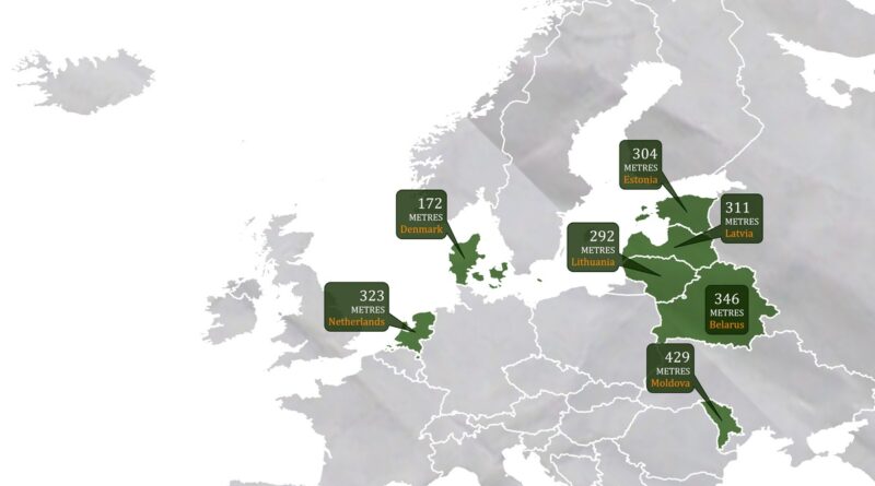
Mountains cover about 35% of Europe, but seven countries remain remarkably flat. Denmark’s highest point barely exceeds 170 meters, while Moldova tops out at 429 meters. These nations share a geological heritage of tectonic stability and glacial smoothing, resulting in landscapes of gentle plains rather than dramatic peaks.
Read More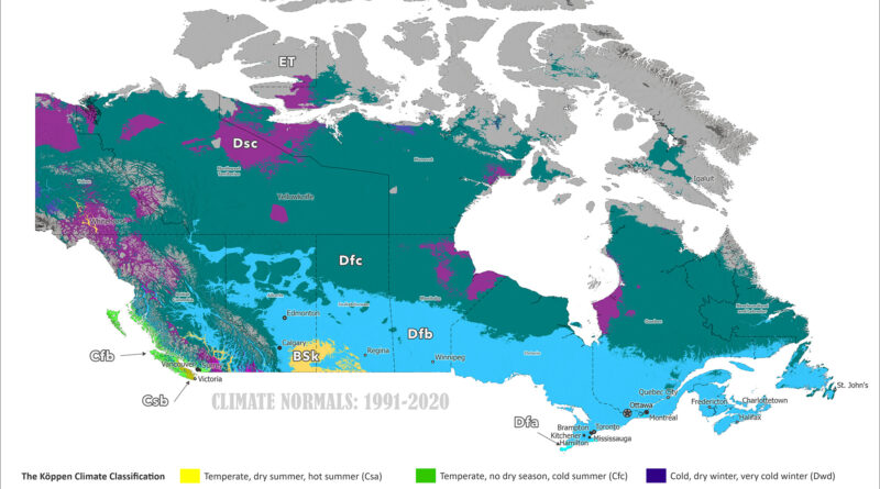
Köppen-Geiger climate maps of Canada reveal dramatic northward shifts from 1901-1930 to 2077-2099. Animated comparisons show tundra retreating to Arctic islands, subarctic zones moving hundreds of kilometers north, tree line advancing, and southern continental climates warming under the ssp2-4.5 scenario.
Read More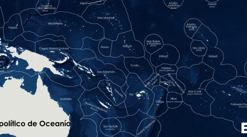
A political map of Oceania shows the region’s vast Exclusive Economic Zones, where small island states like French Polynesia, Micronesia, and the Marshall Islands control huge ocean territories.
Read More