Linguistic composition of Transylvania by municipality (1910)
Red – Hungarian, Purple – Romanian, Green – German
Read MoreHistorical maps showing territorial changes of countries and historical events of the past.
Red – Hungarian, Purple – Romanian, Green – German
Read More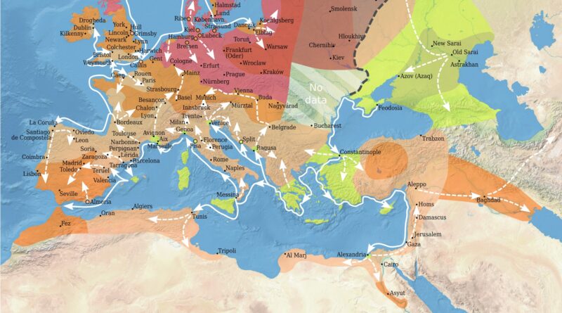
The Black Death reached Europe in 1347 via ships from the Black Sea port of Kaffa. It traveled quickly along principal trade routes, reaching Constantinople, Sicily, and Italy by 1348 and sweeping through France, England, the Holy Roman Empire, and into Scandinavia and Russia by 1351.
The plague followed trade and pilgrimage routes, killing 75 to 200 million humans worldwide. Up to 60% of Europe’s population died, causing vast social, economic, and cultural upheaval.
Read MoreThe peace of Westphalia.
Read MoreIt is difficult to determine the exact population of ancient cities. However, based on historical records and available estimates, here are some cities that were considered significant and populous in different historical epochs, along with their approximate populations.
Read MoreThis is what happened. The video was created with leaflet-headless and leaflet-image. Via blog.webkid.io
Read More