Interactive maps
Global 1-km Cloud Cover
The datasets integrate 15 years of twice-daily remote sensing-derived cloud observations at 1-km resolution. For additional information about the integration
Read MoreMap of Global Cooling
Adjust the temperature of planet Earth using the slide control to view a wildly inaccurate map of how the world
Read MoreAmerica’s unequal schools
This map is a visualization of average high-school SAT and ACT scores and median household income. Each circle on the
Read MoreCoastal Risk Australia
The Coastal Risk Australia website has been developed to help communicate the risks of coastal flooding associated with sea level
Read MoreAmerica’s great housing divide: Are you a winner or loser?
The Post analysis, based on data from Black Knight Financial Services spanning 2004 through 2015, shows how the nation’s housing
Read MoreThe outlines of continents can be visualized by shipping routes
Related posts: – An incredible visualisation of global shipping traffic – All the ships in the World ocean – Visualizing
Read More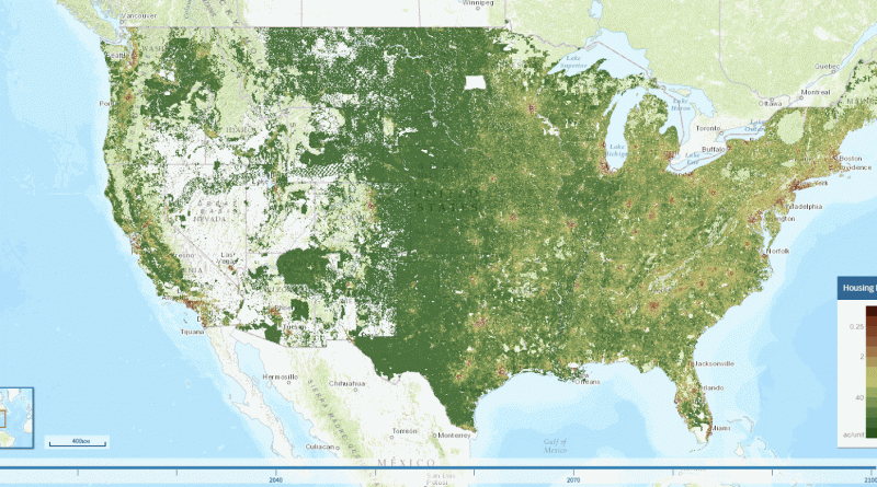
Mapping land use scenarios
The Integrated Climate and Land use Scenarios (ICLUS) outputs are derived from a pair of models. A demographic model generates
Read More