Detailed Cold War-era Soviet military map of the San Francisco Bay area (1980)
Military cartographers created and filled maps with detailed notes on the terrain and infrastructure, construction materials and load-bearing capacity of
Read MoreMilitary cartographers created and filled maps with detailed notes on the terrain and infrastructure, construction materials and load-bearing capacity of
Read More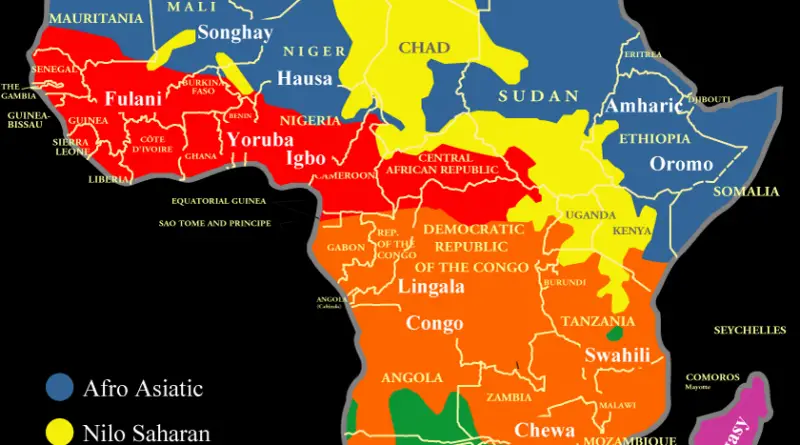
The indigenous languages of Africa are divided into 6 major language families: Afroasiatic, Nilo Saharan, Niger-Congo A, Niger-Congo B (Bantu),
Read More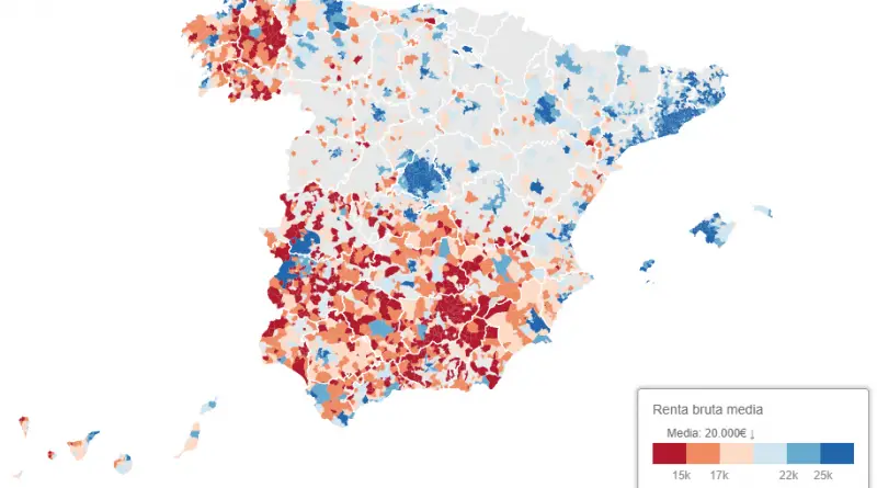
Spain Tax Agency show the significant wealth gap between the rich north and the humble south. People who live in cities
Read More
Source: Randall Munroe xkcd.com You can make these maps say whatever you want by adjusting the methodology. Half the time you’re
Read MoreAverage income per household divided by the number of people per household. Most of the poor people don’t live in
Read MoreLargest Industry in Each U.S. State: NORTH DAKOTA – Oil and gas extraction (Industry output as % of GDP: 7.5%)
Read More
The median income for people in 98 of the biggest cities in the United States was taken from the US
Read More
Population penetration, Baha’i groups in the United States (1980 -2010) youtube Population penetration, Baha’i groups in the United States (2010)
Read MoreThe Environmental Protection Agency tracks 147,354 individual water systems in the U.S. – 81% of those systems are publicly run
Read More
The colored area represents the Netherlands in the time of Charles V. The light green and the dark green distinguish
Read More