Migration to and from London (2013 – 2016)
Visualization of the migration flows data for areas of the England to and from London. election-data.co.uk
Read more: Migration to and from London (2013 – 2016)
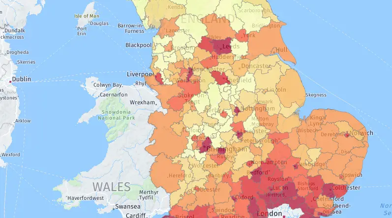
Visualization of the migration flows data for areas of the England to and from London. election-data.co.uk
Read more: Migration to and from London (2013 – 2016)The video below shows the entire history of Northern Europe from the formation of the earliest state-level societies to 2017.
Read more: The History of Scandinavia: Every YearSource: dynamitestudio.ie UK counties:AntrimArmaghDerryDownFermanaghTyrone Ireland’s counties:Carlow –Cavan – Miles awayClare – RocksCork – People’s republicDonegal – Daniel O’DonnellDublin – IkeaGalway
Read more: Stereotypical map of the Ireland’s counties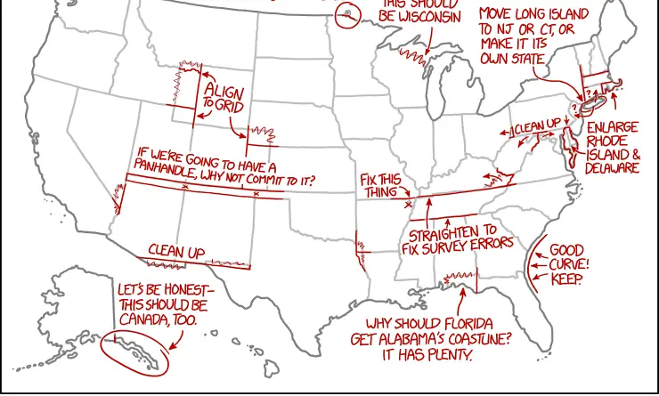
XKCD, is a webcomic created by American author Randall Munroe. The comic’s tagline describes it as “A webcomic of romance, sarcasm,
Read more: XKCD on the design of U.S. state bordersThere are approximately 296 spoken indigenous languages north of Mexico, 269 of which are grouped into 29 families. The Na-Dené, Algic, and Uto-Aztecan families are the largest in terms of several languages.
Read more: Languages of North America, before European colonization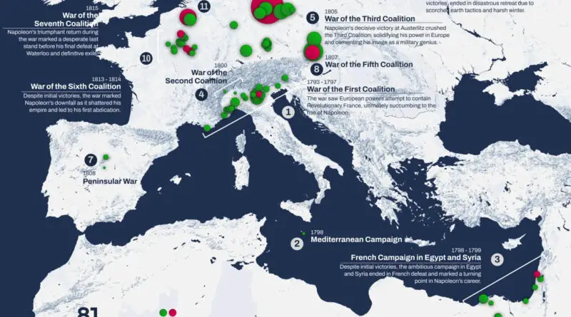
Through comprehensive battle data and Minard’s revolutionary flow map, we explore Napoleon Bonaparte’s military campaigns and his catastrophic 1812 Russian invasion, revealing the staggering human cost of his quest for empire.
Read more: Napoleon’s Military Legacy: From Victory to DisasterPercentage of the Muslim population in Germany. Reddit user: realKkona North Rhine-Westphalia is the most densely populated area of Germany
Read more: Muslims in Germany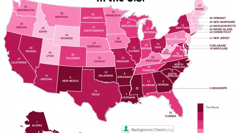
The rate of incidents per 100,000 residents for the two most common sexually transmitted diseases (gonorrhea and chlamydia) and calculating
Read more: The most sexually diseased states in the United States1048: According to the sagas, Oslo (or Aslo) was founded by King Harald Hardrada in 1048. But archaeological finds suggest
Read more: Historical expansion and relocation of Oslo
The legal and cultural expectations for date and time representation differ among nations. It is essential to know all-numeric calendar dates used in a particular country to know what date is expected.
Read more: Date format by country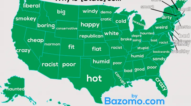
Why is Washington is so liberal, Minnesota – democratic, while Arizona is racist? This map is Google’s representation of our
Read more: How auto-complete describes the U.S. States
The Mercator map is a cylindrical map projection first introduced by the Flemish geographer and cartographer Gerardus Mercator in 1569. The projection is the most heavily used in our society, appearing everywhere from books to apps to Google Maps, and tends to be what most of us think of when pondering the world map.
Read more: The Mercator ProblemsThe map below shows how the United States generates electricity. The circles represent a power source, color represents a type, and
Read more: U.S. electricity sources