Which Countries Eat the Most Butter Per Person?
From Denmark’s 8.55 kg (18.8 lb) a head to India’s 4,976 kt total, here is who eats the most butter, why, and what research says about it.
Read more: Which Countries Eat the Most Butter Per Person?
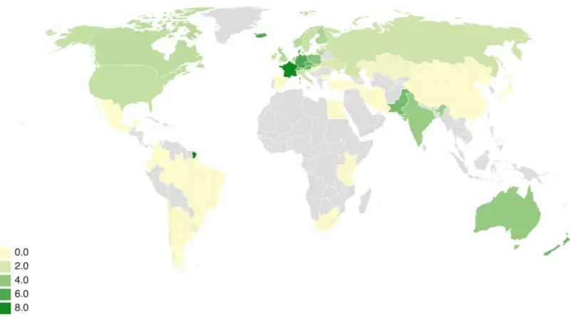
From Denmark’s 8.55 kg (18.8 lb) a head to India’s 4,976 kt total, here is who eats the most butter, why, and what research says about it.
Read more: Which Countries Eat the Most Butter Per Person?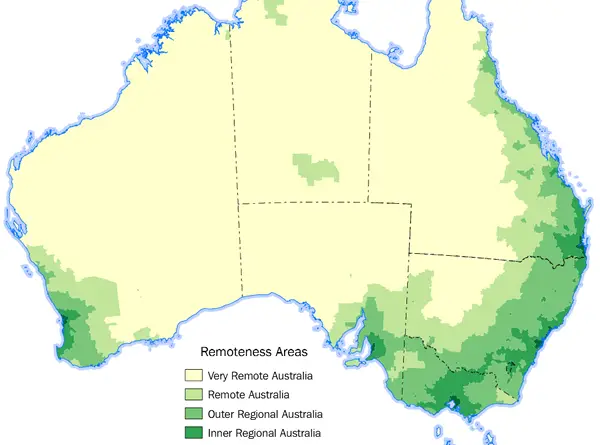
Five remoteness classes cover Australia, and 73% of residents live in Major Cities. The dry centre is empty because of climate, and the rainy north because of cyclones, poor soils and distance.
Read more: Remoteness of Australia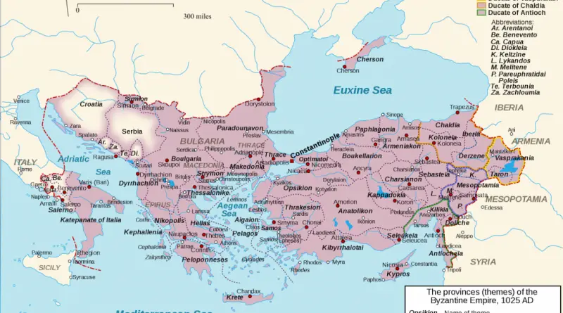
Basil II died in December 1025 while planning to retake Sicily. The empire he left behind reached from southern Italy to the Caucasus.
Read more: The Byzantine Empire at its Heyday (1025AD)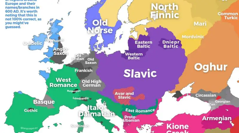
A Roman monk was working on a pagan king in Kent while Avars and Slavs pressed the Byzantine frontier. A quick look at Europe in 600 AD.
Read more: Map of Europe in 600 AD
Nearly half of EU residents speak English as a foreign language, while the other major languages stay close to home.
Read more: Which Languages Do Europeans Speak Besides Their Own?San Francisco has the third-oldest housing of the 100 largest U.S. counties. A parcel-level map by Danny Yang shows where the oldest buildings are.
Read more: Mapping San Francisco Building AgesThe Han Chinese are the largest ethnic group in China, covering about 92 per cent of its mainland population. Other
Read more: The Peoples of China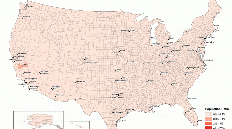
Orthodox Christians as a Percentage of all Residents, 1952 – 2010 Orthodox Christians as a Percentage of all Residents, 2010
Read more: Orthodox Christians as a Percentage of all Residents (1952 – 2010)
Ludacris named 43 U.S. area codes in his 2001 hit. Mapped out, they follow the East Coast and the South, with six in the Far West and none in the Rocky Mountain states.
Read more: Ludacris’s Area Codes Song, Mapped Across the U.S.A kilowatt-hour costs about four times more in Hawaii than in Nevada, and prices moved in different directions this year.
Read more: Map shows the average cost of electricity per U.S. state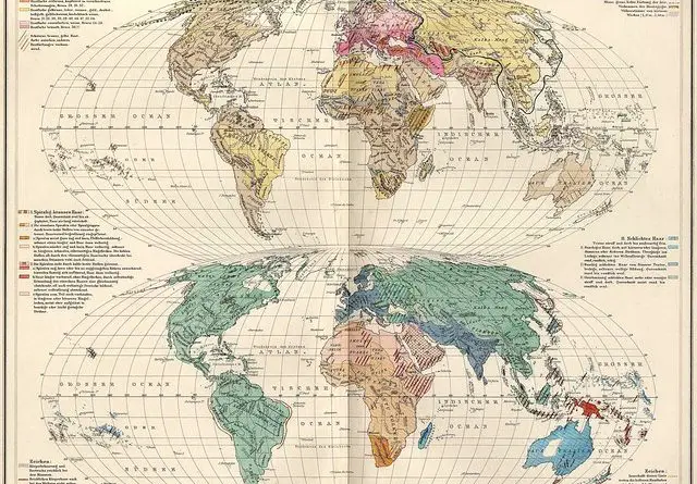
The idea of race as a rough classification of anatomically modern humans has a problematic history. Before the 19th centuries, the word ‘race’ was used in the sense of “ethnic group” and got its contemporary meaning in the area of anthropology only from the mid-nineteenth century.
Read more: Distribution of Human Races in the 19th CenturyMilitary cartographers created and filled maps with detailed notes on the terrain and infrastructure, construction materials and load-bearing capacity of
Read more: Detailed Cold War-era Soviet military map of the San Francisco Bay area (1980)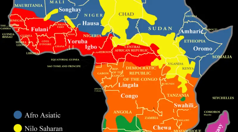
The indigenous languages of Africa are divided into 6 major language families: Afroasiatic, Nilo Saharan, Niger-Congo A, Niger-Congo B (Bantu),
Read more: Language families spoken in Africa