Countries with a smaller GDP than the U.S. military budget
In 2020 the military budget of the United States was about $721.5 billion. It is the largest military budget in the world.
Read More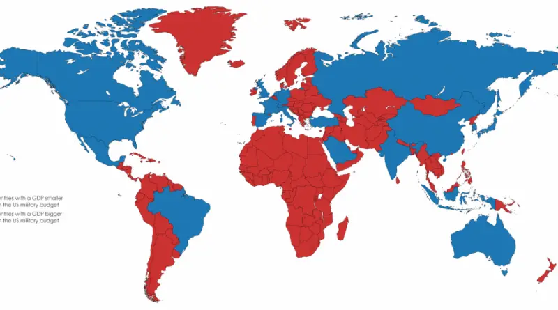
In 2020 the military budget of the United States was about $721.5 billion. It is the largest military budget in the world.
Read More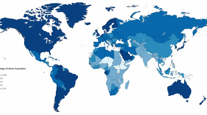
Reddit user: Irmfried The world average percentage of urban population is 54.3%, compared to 46.5% in 2000 and 33.6% in 1960.
Read MoreReddit user: Irmfried
Read MoreReddit user: Borysk5 Countries without compulsory schooling: Vatican, Oman, Bhutan, Solomon Islands.
Read More
Reddit user: OnePartyRule
Read More
“States of integration estimated figures for public grade and high schools.”
Read MoreReddit user: hcomme
Read More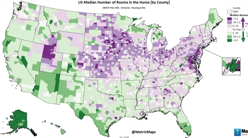
Via metricmaps
Read More