Global temperature anomalies in 2016
2016 was the warmest year on record: +0.83 °C +/− 0.10 °C warmer than the average for the 1961–1990 reference
Read MoreLa Louisiane (1719)
French North America.
Read More
Airbnb prices around Europe
Airbnb prices around Europe
Read More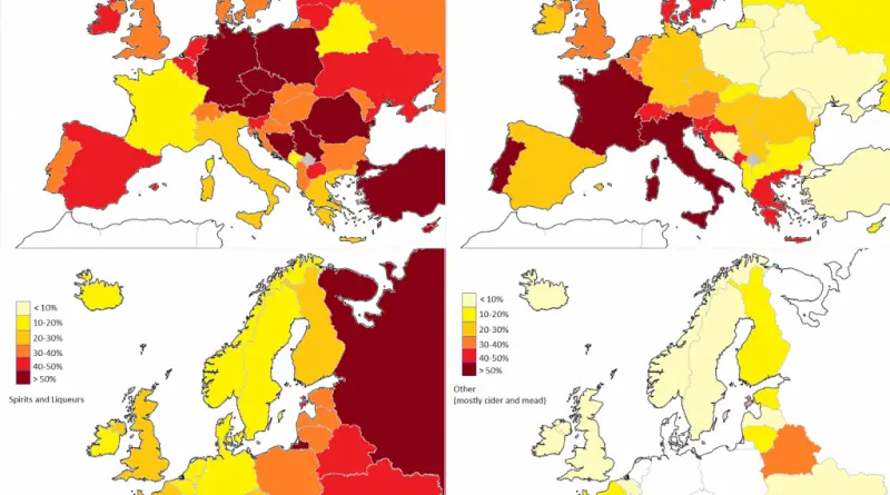
The most consumed type of alcoholic drink in Europe
Alcohol choices in Europe vary from nation to nation between spirits, beer, wine. These favorites are traditionally linked with certain regions. Therefore, the Central European countries are associated with beer drinking, the Mediterranean with wine drinking. Meanwhile, the Northern and Eastern European countries are spirit-drinking nations.
Read MoreThe legality of Cannabis Around the World
The legality of cannabis for medical or recreational use differs by nation, cultivation, distribution, possession, and how it can be used. he legalization of cannabis has become more widespread, and that course will continue.
Read More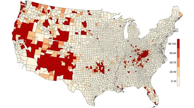
Midlife “Deaths Of Despair” in the United States (2000 vs 2014)
“Deaths of despair,” encompassing suicides, drug overdoses, and alcohol-related diseases, have significantly impacted midlife mortality in the United States. This article delves into the causes, trends, and geographical hotspots of these tragic deaths, with a focus on economic distress and educational attainment. Discover current trends, preventive tips, and detailed insights into how different regions are affected.
Read MoreRoad and Aviation Noise in the U.S.
The noise map facilitates the tracking of trends in transportation-related noise, by mode, and collectively for multiple transportation modes. The
Read More