
The police practice of keeping digital record activities of ordinary citizens
Law enforcement agencies have for decades used what’s known as field interview or contact cards to document everything from sketchy
Read More
Toronto’s air pollution monitoring map
NHALE is the first community air monitoring project in Canada. Jointly led by Environment Hamilton and Toronto Environmental Alliance with
Read MoreStar Mapper: A visualisation based on data from the European Space Agency’s Hipparcos star mapper
The visualisation tour is divided into five sections: Apparent Magnitude, Absolute Magnitude, Hertzsprung-Russell, Motion, and Explore. Apparent Magnitude The apparent
Read MoreDisposable income of private households per capita (PPP)
Yearly income after taxes adjusted according to differences in price levels in different countries.
Read More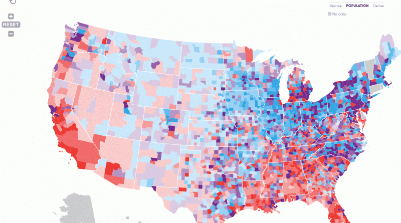
Jail incarceration rate per 100,000 U.S. county residents
In 2014, the nationwide jail incarceration rate of 326 per 100,000 county residents exceeded the highest county rates registered in
Read MoreEnd of the recognition of the Republic of China
There has been countries that restablished recognition of the Republic of China and ended it later. In this map, the
Read More