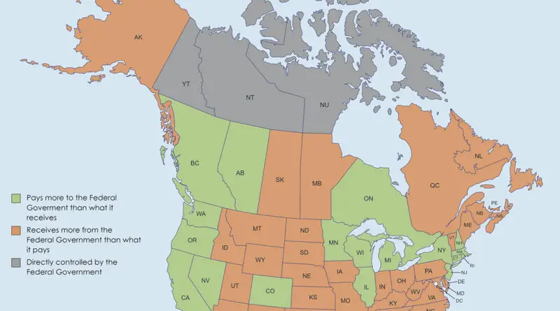
Historical Maps

The Oldest Cities in the U.S. Mapped

In 1513, Spanish adventurer Juan Ponce de Leon surveyed Florida. He anchored at St. Augustine, trying to find the Fountain of Youth. It is the oldest city in the continental U.S. Declared as a Spanish land, Ce was established in 1565. That’s a whole 42 years before Jamestown in Virginia. It’s 55 years before the Pilgrims anchored at Plymouth Rock.

Read More
Historical Maps

Evolution of France’s Borders Mapped

France’s borders remain a testament to its rich and complex history, reflecting the interplay of conquest, diplomacy, and geopolitics over the centuries. From the medieval domains of the Capetian kings to the modern-day republic, the evolution of France’s borders is a fascinating journey through time, shaped by the ambitions and aspirations of its rulers and people.

Read More
Environment maps

Bears in Europe Mapped

The Eurasian brown bear has brown fur, a robust bone structure, and massive paws equipped with claws that can grow up to 10 cm or 3.9 inches long. A full-grown male weighs, on average, 250-300 kilograms (550-660 lb) and reaches a maximum weight of 481 kilograms (1,060 lb), and is nearly 2.5 meters or 8.2 feet long.

Read More