First global antineutrino emission map highlights Earth’s energy budget
The first-ever global map of antineutrino flux, which accounts for natural and human-made sources of antineutrinos, with the latter making
Read MoreThe Great War (1914)
War map of Europe (1914) American map of Europe with statistics of the nations (population, length of railroads, telegraphs and
Read More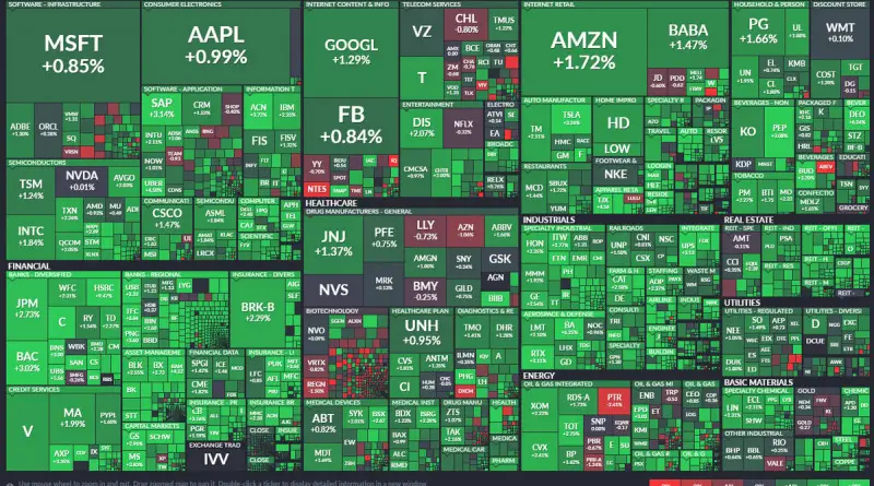
The stock market maps
A stock market map is an intuitively visual depiction of real-time and historical market information. You can use these maps as an investment analysis tool to observe the performance of various market indices, asset classes, sectors, or specific stocks.
Read MoreFederal net revenue per state
Government spending subtracted from Government revenue.
Read More