Comparison of the Wealth
National net wealth is the total amount of the value of a nation’s assets minus its debts. It refers to the total value of net wealth owned by the residents of a nation.
Read more: Comparison of the Wealth
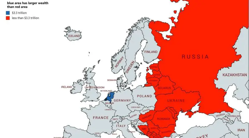
National net wealth is the total amount of the value of a nation’s assets minus its debts. It refers to the total value of net wealth owned by the residents of a nation.
Read more: Comparison of the Wealth
With a laurel crown upon his head and the Grande Armee at his command, Napoleon Bonaparte, Emperor of the French, led his sovereign proto-nation down a path diverging from the Republican principles it fought so long to uphold, espousing devotion to the spirit of the revolution under autocratic rule – his rule.
Read more: The Ephemeral States of the Napoleonic Period
Panama Canal was opened on August 15, 1914. France began work on the canal in 1881 but stopped due to a high worker mortality rate. The U.S. took over the project in 1904.
Read more: The kiss of the oceans (1915)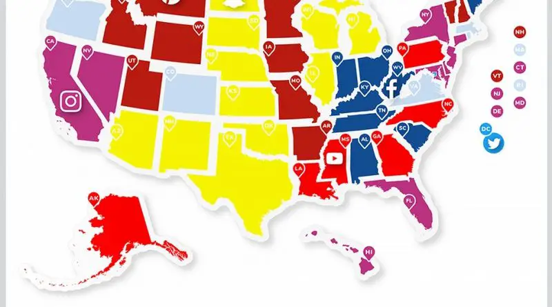
Social networks are internet social media sites to stay connected with family, friends, colleagues, or clients. Facebook remains the largest and most popular social network worldwide, with almost 3 billion users using the platform monthly.
Read more: Most Popular Social App by U.S. State
Sleep insufficiency is the condition of insufficient duration or quality of sleep to sustain proper attention, performance, and health. It’s estimated that sleep insufficiency affects almost 1/3 of American adults.
Read more: Insufficient sleep in every US county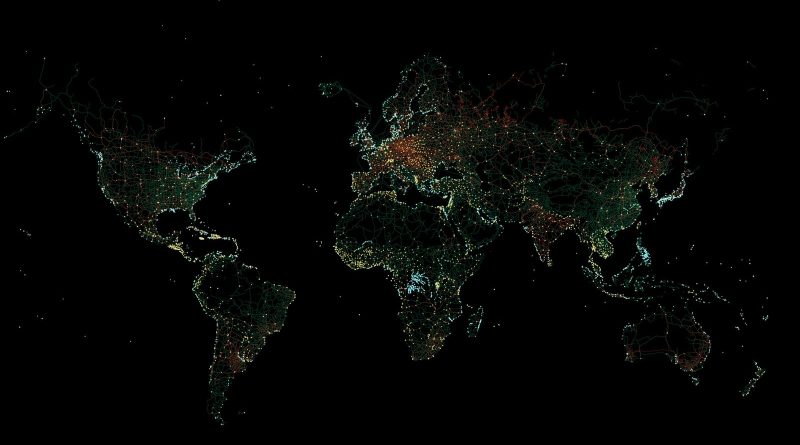
3 percent (4.5 million km2 / 2.8 million mi2) of the Earth’s land cover is occupied by urban areas. However, even non-urban areas contain roads, railroads, and other marks of human presence. Only ten percent of the world is indeed a wilderness.
Read more: Human-made Infrastructure Mapped
Today, the number of children aged 0-4 in the U.S. is 19.7 million. Between 2008 and 2020, the population aged 0-4 years in the United States was declining on average by 0.51 percent every year, although, before that, it rose from 16.6 million persons in 1979 to 21.1 million persons in 2008.
Read more: U.S. population aged 0-4 year
The lowest risk has most European nations – Australia, Canada, United States, New Zealand, as are Azerbaijan, Armenia, Georgia, Jordan, Iran, Kuwait, Oman, Qatar, the UAE, and Uzbekistan in the Middle East.
Read more: The worst and safest countries for travel
The U.S. population is distributed unevenly. The Census evaluates that in the U.S. population living across over 3,000 counties. A mere 140, or 4.5%, of U.S. counties, are home to approximately 50% of those people.
Read more: The U.S. Population Lines
The population of kids aged 14 and under is about 61.4 million in 2020, representing 18.5 percent of the United States population. Population aged 0-14 years of the U.S. fell steadily from 26.9% in 1972 to 18.5% in 2020.
Read more: U.S. population aged 0-14 years
Combined Statistical Areas represent multiple metropolitan or micropolitan areas that have an employment interchange of at least 15 percent.
Read more: Most Populous Combined Statistical Areas in the U.S.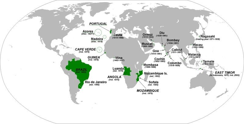
The Portuguese Empire was one of the biggest and longest-lived empires in world history; it existed for nearly 6 centuries, from the capture of Ceuta in 1415 to the handover of Portuguese Macau to China in 1999. The Second Portuguese Empire spanned 5.4 million square kilometers or 2.12 million square miles at its peak.
Read more: Map of all territories of the Portuguese Empire (1419-1999)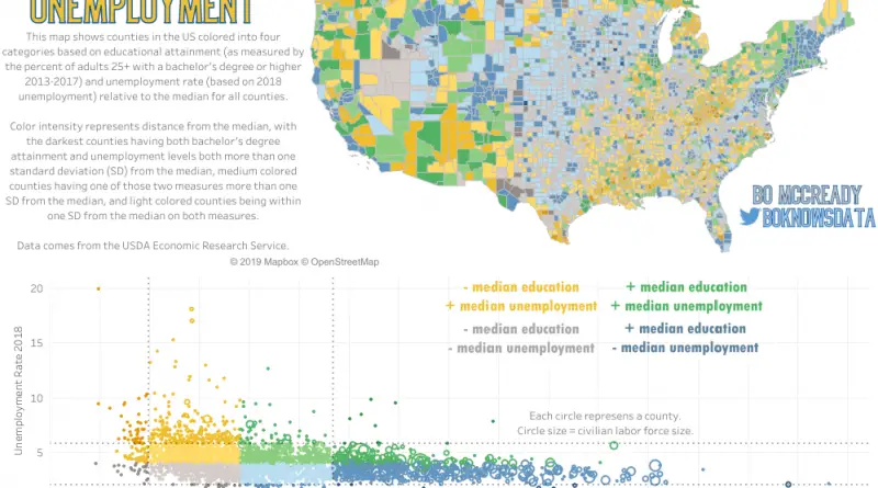
Job openings in healthcare, community services, and STEM (science, technology, engineering, and mathematics) will grow the fastest among occupational clusters. American adults hold approximately 16.7 million bachelor’s degrees in science, technology, engineering, and mathematics (75 degrees per 1,000).
Read more: Education and Unemployment by U.S. Country