Old maps

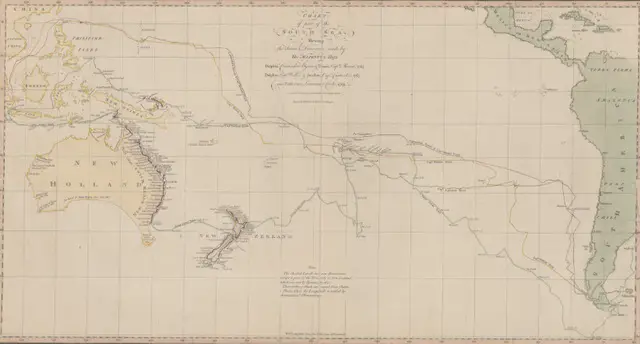
“Chart of part of the South Sea” (1770): A Landmark in Pacific Ocean Mapping

Step into the world of 18th-century exploration with this revolutionary 1770 chart of the South Sea – the first published map to show Australia’s eastern coastline and New Zealand’s complete outline. Created during Captain Cook’s first voyage, this remarkable document changed our understanding of the Pacific Ocean forever.

Read more: “Chart of part of the South Sea” (1770): A Landmark in Pacific Ocean Mapping
Cities

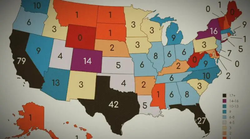
How Many Cities with a Population of 100k+ does Each U.S. State Have?

Have you ever wondered how many large cities are in each U.S. state? From the bustling metropolises of California to the smaller yet significant urban centers scattered across the country, the distribution of cities with a population of over 100,000 can reveal interesting insights into the demographic landscape of the United States.

Read more: How Many Cities with a Population of 100k+ does Each U.S. State Have?
CitiesPopulation

The Population of Manhattan Mapped

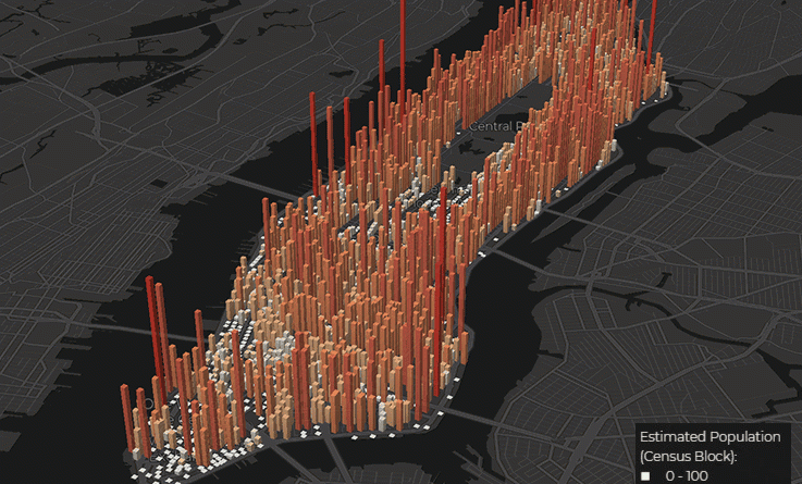
In 1910, Manhattan crammed 2.3 million residents into 22 square miles—a density the borough has never matched since. By 2025, the overnight population sits around 1.7 million. But Manhattan’s real story isn’t about who lives here anymore. Every weekday, the island swells to nearly 4 million people by early afternoon, then empties out again each night. Midtown hits densities comparable to Mumbai and Macau at peak hours, while neighborhoods north of Central Park lose residents during work hours. Maybe the question isn’t how many people live in Manhattan—it’s how many people Manhattan holds at any given moment.

Read more: The Population of Manhattan Mapped