United States
Maps of the US
Where billions of cicadas will emerge this spring & the next decade
For 17 years, cicadas do very little. They hang out in the ground, sucking sugar out of tree roots. Then,
Read MoreWhere is the U.S. GDP concentrated?
According to the Bureau of Economic Analysis data, only 31 U.S. counties made up about 33 percent of U.S. Gross Domestic Product. GDP concentration in the U.S. 81 counties produced 50 percent of the nation’s GDP.
Read MoreA day with no metro in Washington
A Day with No Metro: The Metro system shut down for emergency repairs on March 16, 2016. This map visualizes
Read MoreHow Every New York City Neighborhood Voted in the Democratic and Republican Primary
How every New York City neighborhood voted in the Democratic Primary How every New York City neighborhood voted in
Read MoreFlorida Dis-United: The Ten Distinct States That Make Up Florida
Florida has a reputation as America’s weirdest state, but there’s hardly any national appreciation for the fact that Florida has
Read More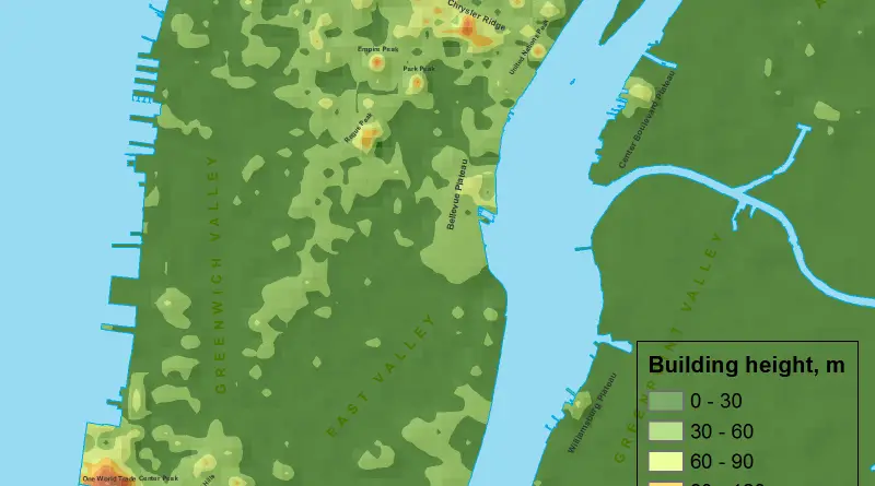
If Manhattan was a mountain…
The skyline of Manhattan, New York City, stands as a testament to architectural innovation and urban development. Marked by iconic skyscrapers, the height of buildings in Manhattan is a defining characteristic of the city’s landscape. The island has been a focal point for vertical expansion, with structures reaching impressive heights that not only serve practical purposes but also contribute to the visual identity of the city.
Read MoreSpending per student, by school district
Via npr.org
Read More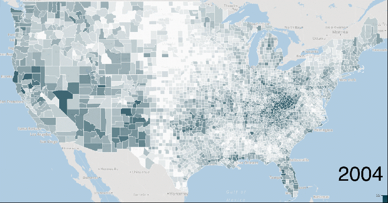
The stunning spread of the opioid painkiller and heroin epidemic
Every day in America, more than 50 people die from an overdose of prescription pain medication. Some people who start
Read More