A year of population change
Percent change in U.S. resident population 2014 – 2015. Via washingtonpost.com Related posts: – U.S. Population under 5 years of
Read MoreMaps of the US
Percent change in U.S. resident population 2014 – 2015. Via washingtonpost.com Related posts: – U.S. Population under 5 years of
Read MoreRelated posts: – New York City transit frequency – Yellow Taxi Trips (2015) – TV Shooting Locations in New York
Read More– On average, the life expectancy for a poor 40-year-old in Manhattan is 81.8 years. It is one of the
Read MoreClinton’s vote share (April 10, 2016) Sander’s vote share (April 10, 2016)
Read MoreRelated posts: – Imprisonment rate of sentenced prisoners under the jurisdiction of state or federal correctional authorities per 100,000 US
Read More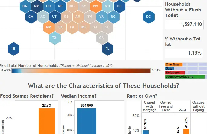
1.19% of households in the U.S. don’t have a flush toilet.
Read More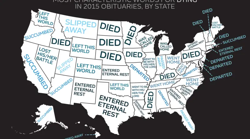
“Passed away” was used in 32.5 percent of all obituaries and topped the national list. In every single state, it
Read More