Locals vs Tourists: The most divisive attractions in the United States
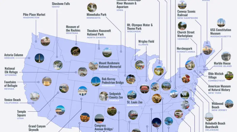
While the over 2 million annual visitors to Mount Rushmore rate the monument 4.60/5 stars on average, locals give an average rating of 4.17/5 – the largest differential of any major U.S. attraction. On the other hand, LA locals rate Venice Beach an average of 3.95/5 stars, far more than the 3.63/5 star average among tourists – the most significant differential of any attraction favored by locals.
Read More