72 Million Americans Depend on Drinking Water From Small Streams
The data EWG used are drawn from a 2009 EPA study that analyzed “regional patterns of dependence on intermittent, ephemeral
Read MoreMaps of the US
The data EWG used are drawn from a 2009 EPA study that analyzed “regional patterns of dependence on intermittent, ephemeral
Read More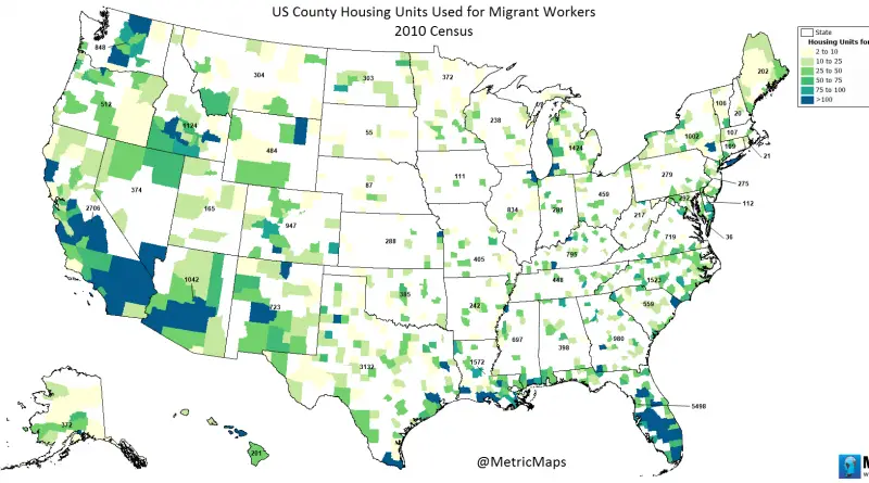
www.metricmaps.org/2017/03/02/us-county-housing-units-used-for-migrant-workers
Read More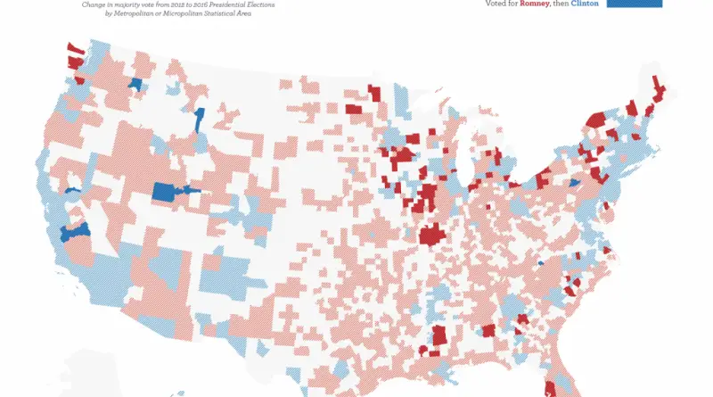
Change in majority vote from 2012 to 2016 Presidential Elections by Metropolitan or Micropolitan Statistical Area. 80 cities that flipped
Read More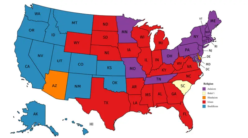
Source: Reddit / user: Jedicobra Related posts: – Overall religiosity by U.S. State – Catholic Ecclesiastical Provinces in the United
Read More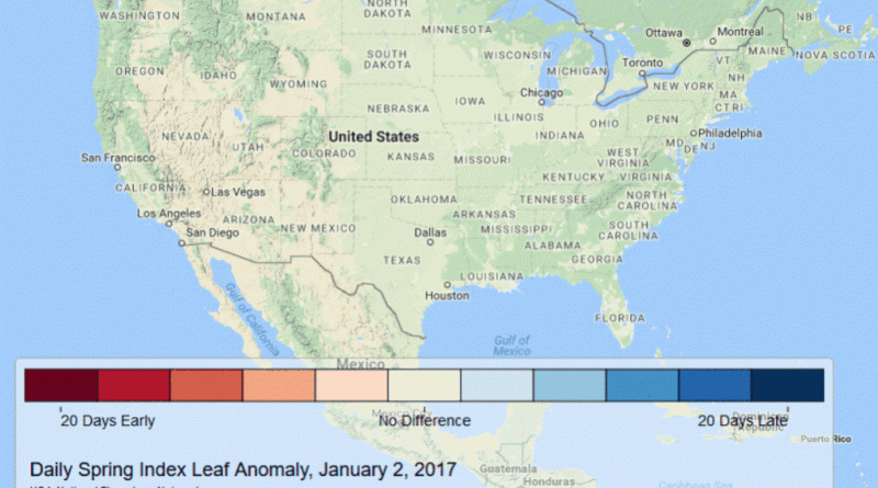
Spring is arriving very early this year . . . at least 2-3 weeks early across almost the entire Southeast,
Read MoreDetailed vegetation map in The National Atlas of the United States of America (USGS, 1970, Gerlach). This 1:7,500,000-scale map, in
Read More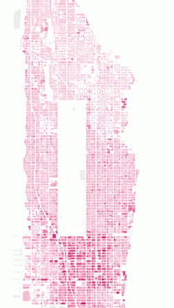
Building Height in Manhattan New York City has over 6 thousand high-rise buildings in total, 274 of which are skyscrapers
Read More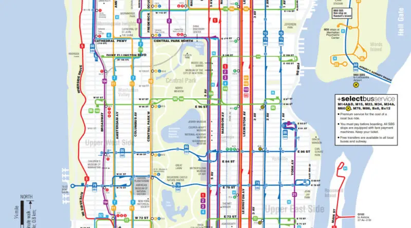
Dive into the complex world of New York City’s transportation system. From subway-only commutes to the impact of bus routes, uncover how different modes of transit affect accessibility across the city’s diverse neighborhoods. Explore interactive maps and borough-specific commuting data to gain insights into navigating the urban landscape of the Big Apple.
Read MoreExperience lower Manhattan in a whole new way with a new interactive 3D map. Related posts: – How tall will new
Read More