English Speakers by Country
English is a West Germanic language that was first spoken in early medieval England and is now a global lingua
Read MoreMap of all of the surface of Earth. Maps of continents, countries, regions, and cities.

English is a West Germanic language that was first spoken in early medieval England and is now a global lingua
Read MoreReddit user: gabechko Related post: – Largest foreign-born population in each French department by country of birth
Read More
Wooden Ships explores European maritime activity and observations from 1750 to 1850. The data consists of logbook entries written by
Read More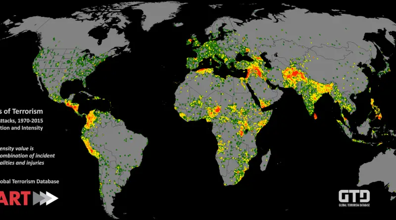
Map of every recorded terrorist attack (combining fatalities and injuries) between 1970 and 2015 Source: Global Terrorism Database
Read MoreThat world map on your wall? It’s not telling you the whole truth. Here’s why countries aren’t the size you think they are, and what our world actually looks like.
Read More