Earth according to population density
World population density represented as elevation. Source: cartoma-hamelberg.com
Read More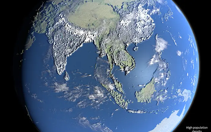
World population density represented as elevation. Source: cartoma-hamelberg.com
Read MoreThis 3D web map allows users to learn more about the Morningside Heights Historic District, which the New York City
Read MoreExperience lower Manhattan in a whole new way with a new interactive 3D map. Related posts: – How tall will new
Read MoreWeekend vs. working days population density. Residents, per square kilometer Workday people, per square kilometer Via plumplot.co.uk
Read MoreThe London Atmospheric Emissions in 3D. Greater London Annual Mean NO2 modeled concentrations for 2020 on a 20m grid. Related
Read MoreThis 3D map shows what construction will do to every neighborhood’s skyline to help you see how you could be
Read MoreWhere are the tallest buildings in Vancouver? Where are the towers with podiums, or the walk-up apartment buildings, or the
Read More
Unemployed rate, aged 15 years or older. Via ubilabs.net
Read MoreESRI Data
Read More