The First Mexican Empire: A Forgotten Chapter of North American Territorial Grandeur
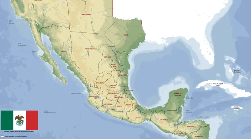
A deep dive into Mexico’s forgotten imperial moment: how a young nation briefly controlled a massive territory stretching from Oregon to Central America, and the complex historical forces that shaped its extraordinary, yet brief existence.
Read More